
Thibet, Mongolia, and Manchouria
London: Tallis, John, 1851.
Map. Steel engraving with early outline color. Image measures 9.75" x 12.75".
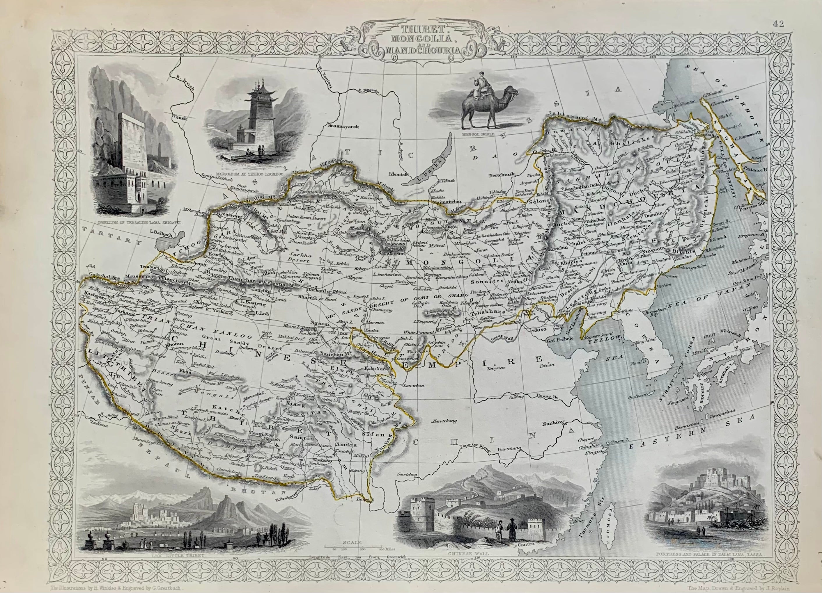
This map of Tibet, Mongolia and Manchuria offers both geographical and cultural overviews. It extends from modern day Himachal Pradesh in northern India to Sakhalin Island and the Sea of Okhotsk in the North Pacific Ocean, corresponding to the ancient Mongol Empire of Genghis Khan. Karakorum, Genghis Khan's abandoned capital is noted here. The region is abundantly labeled with the names of cities, rivers and ancient kingdoms. The decorative vignettes around the map amplify the cultural milieu perceived at the time. These include views of the Chinese Wall, the fortress and palace of Dalai Lama in Lassa, Leh or Little Tibet in India, the dwelling of Tessaling Lama in Shigatzi, Mausoleum at Teshoo Loomboo and a Mongol Noble. Surrounded by an ornate border. The map is from R. Montgomery's "Illustrated Atlas and Modern History of the World." It is in good condition. No center fold or crease as is common with this map. John Tallis Jr. (1817-1876) was a London born bookseller who continued the prolific map publishing company started by his father. After a partnership with his brother, Tallis Jr. expanded the business to New York in 1849 as well as Boston, Cincinnati, Rochester, Philadelphia and Baltimore. He is remembered as one of the last decorative map makers, and this lovely map exemplifies his work.
Illustrator: RAPKIN, John
Binding: Unbound
Language: English
Price: $200.00
Item #313646