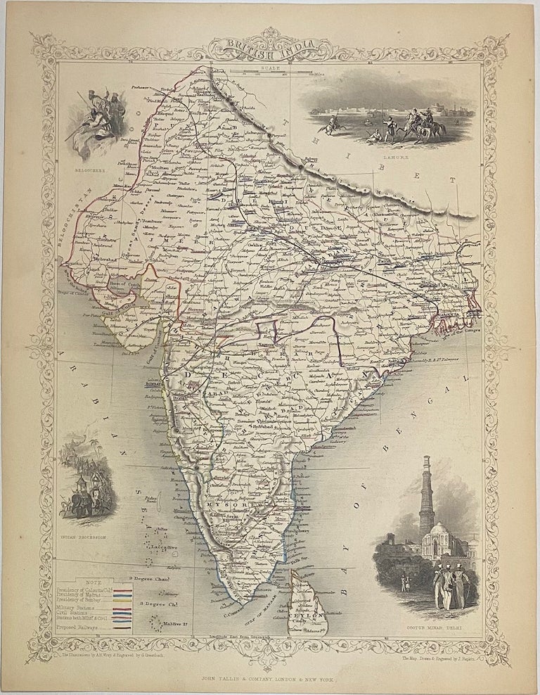
British India
London: John Tallis & Company, 1860.
Map. Steel engraving with outline hand color. Page measures 13 7/8" x 10 5/8"
Lovely map of India in the mid-19th century. Features four vignettes showing the Beloochee's; Lahore; Cootub Minar, Delhi (a world heritage site); and Indian Procession in the lower left with elephants. Hand colored to show proposed railroads connecting Bombay, Calcutta, and Delhi. Regions are also colored, representing the Presidencies of Madras, Calcutta, and Bombay; as well as territories controlled by the British. Includes Nepal and part of Ceylon. In good condition with minor tears to margin. Map drawn and engraved by J. Rapkin, illustrations by A. H. Wray and engraved by G. Greatbach.
John Tallis Jr. (1817-1876) was a London born bookseller who continued the prolific map publishing company started by his father. After a partnership with his brother, Tallis Jr. expanded the business to New York in 1849 as well as Boston, Cincinnati, Rochester, Philadelphia and Baltimore. He is remembered as one of the last decorative map makers.
Illustrator: Rapkin, J.
Binding: Unbound
Language: English
Price: $200.00
Item #313504