
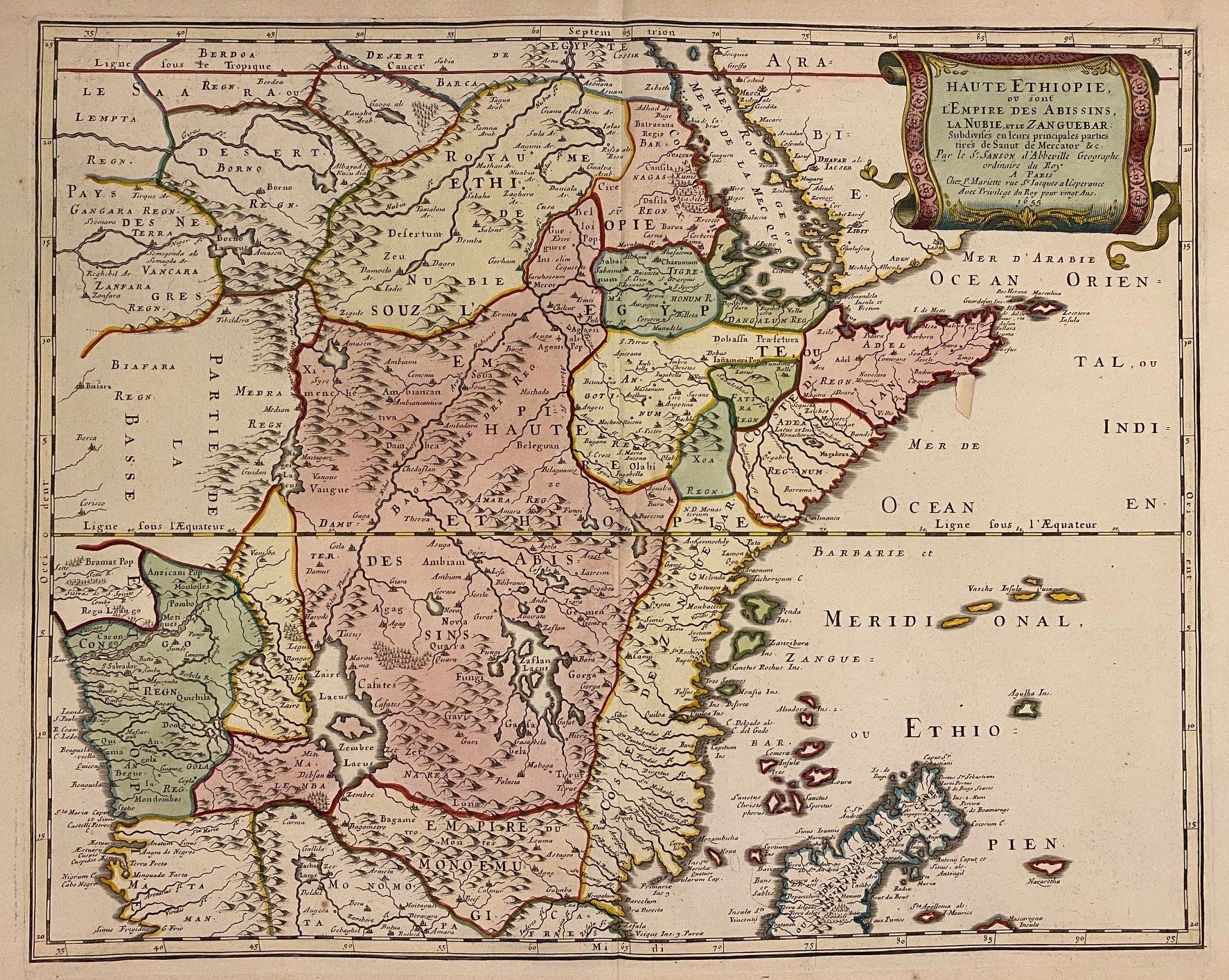
Haute Ethiopie ou sont l'Empire des Abissins
Amsterdam: Pierre Mariette.
Map. Engraving with hand coloring. Image measures 15 1/2" x 19 1/2"
This map shows the regions of Ethiopia, Nubia, and Zanguebar, which in the 18th century comprised the coast of East Africa from the Red Sea to the Eastern Cape. A number of islands in the Indian Ocean are included. Mountains, forests, and major cities are depicted pictorially. The map extends to the Atlantic Ocean in the lower left corner of the map, showing part of the western coast around the Congo River delta. Divided and hand-colored by kingdom according to Sanut and Mercator, as credited by Sanson in the cartouche. It is in very good condition, with some spotting at margins not affecting the image.
Nicolas Sanson (1600-1667) is considered the founder of the French school of cartography. In reaction to the prevailing trend of Dutch lavishness, Sanson favored minimal details, focusing rather on accurate cartography than ornament. His miniature maps, such as this one, were popular and widely imitated.
Binding: Unbound
Language: English
Price: $600.00
Item #313082