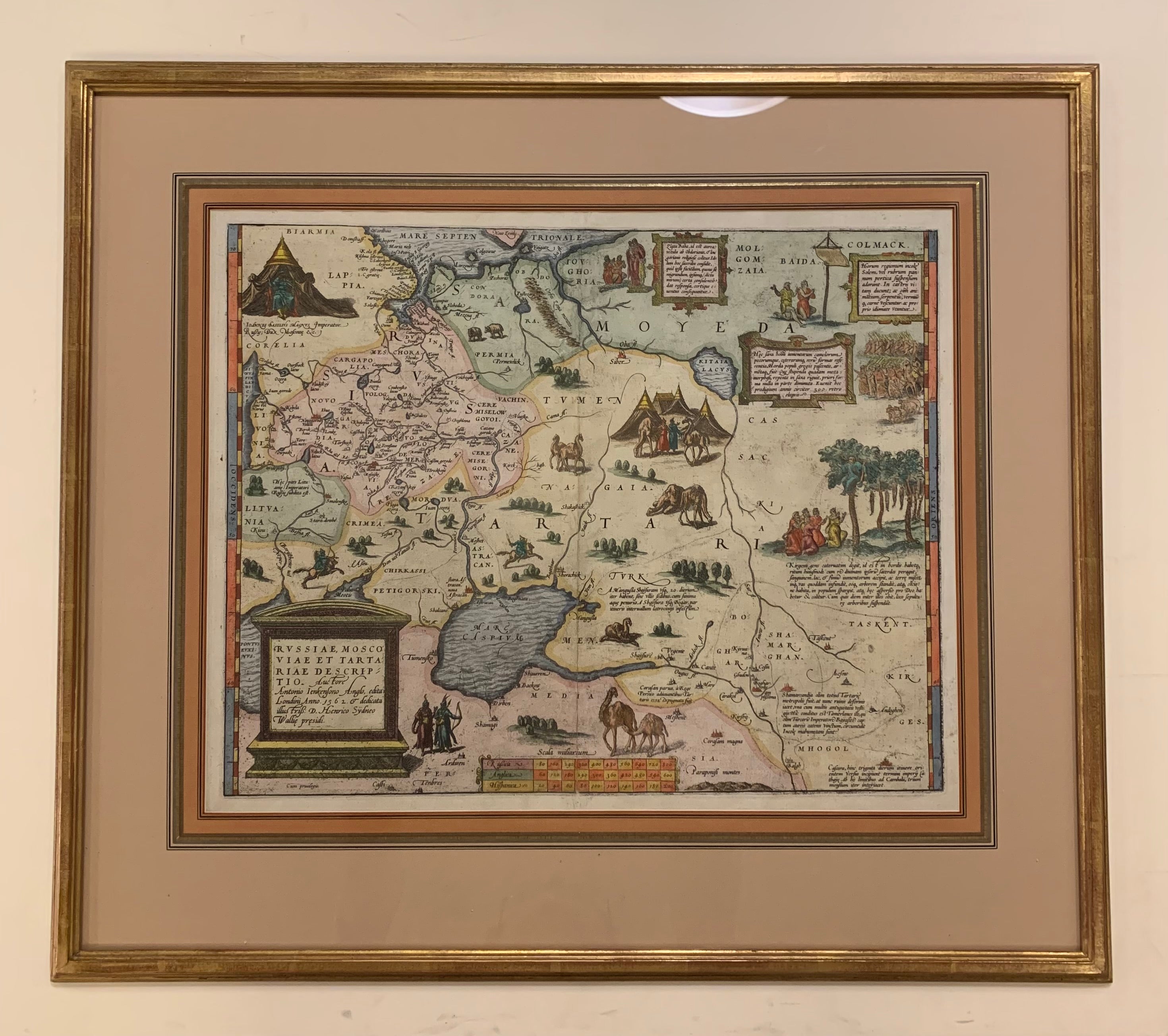
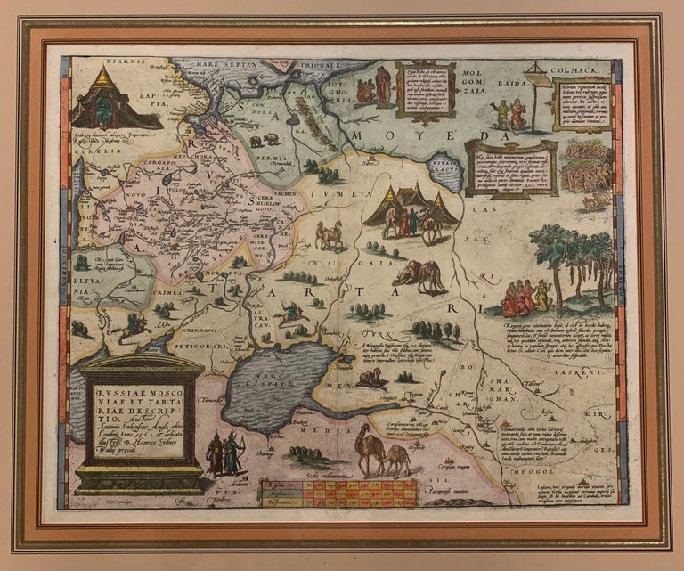
Russiae, Moscoviae et Tartariae Descriptio.
Antwerp: Ortelius, Abraham, 1608.
Map. Engraving with beautiful hand coloring. Image measures 14" x 17.5". Gold frame with empire matting 22 1/2 x 25 1/2 inches.
Exquisite circa 1608 map of western Russia from the Baltic States, shows the Gulf of Finland, to just beyond the Ob' River in Western Siberia. Includes the Caspian Sea. Richly decorated with folkloric vignettes with descriptions of obscure religious rites to match. Compilation map based on travel accounts. From "Theatrum Orbis Terrarum". Not examined out of frame. A beautiful example of this lavish map. Abraham Ortelius (1527-1598), a Flemish cartographer and geographer, is widely regarded as one of the important and influential cartographers in history. He is known for his "Theatrum Orbis Terrarum," which was the first modern atlas. Van den Broecke #162
Binding: Framed
Language: Latin
Price: $2,800.00
Item #312587