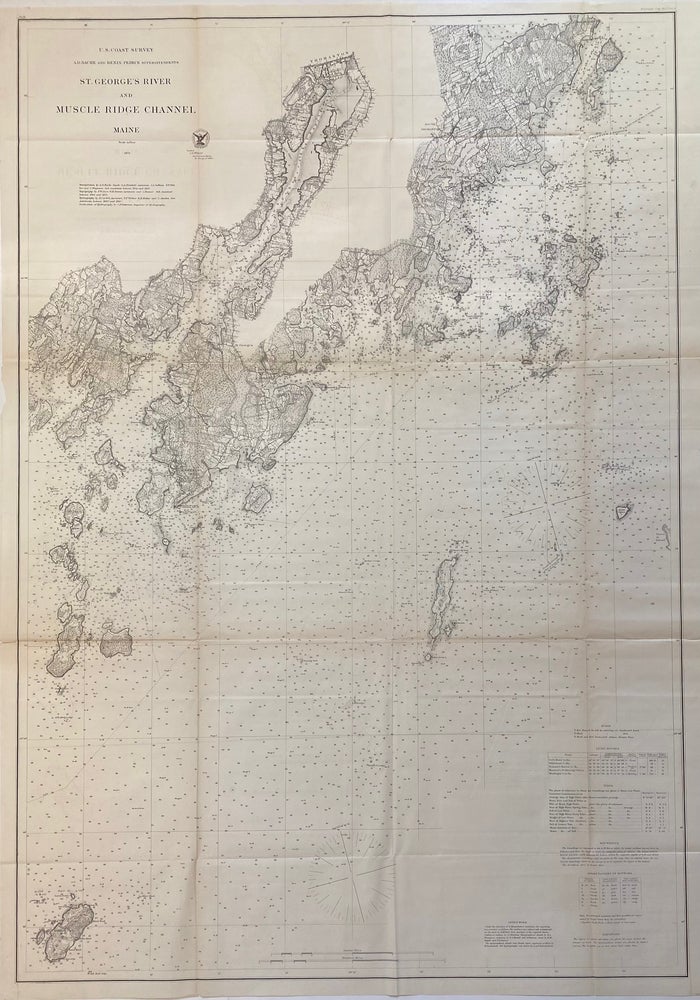
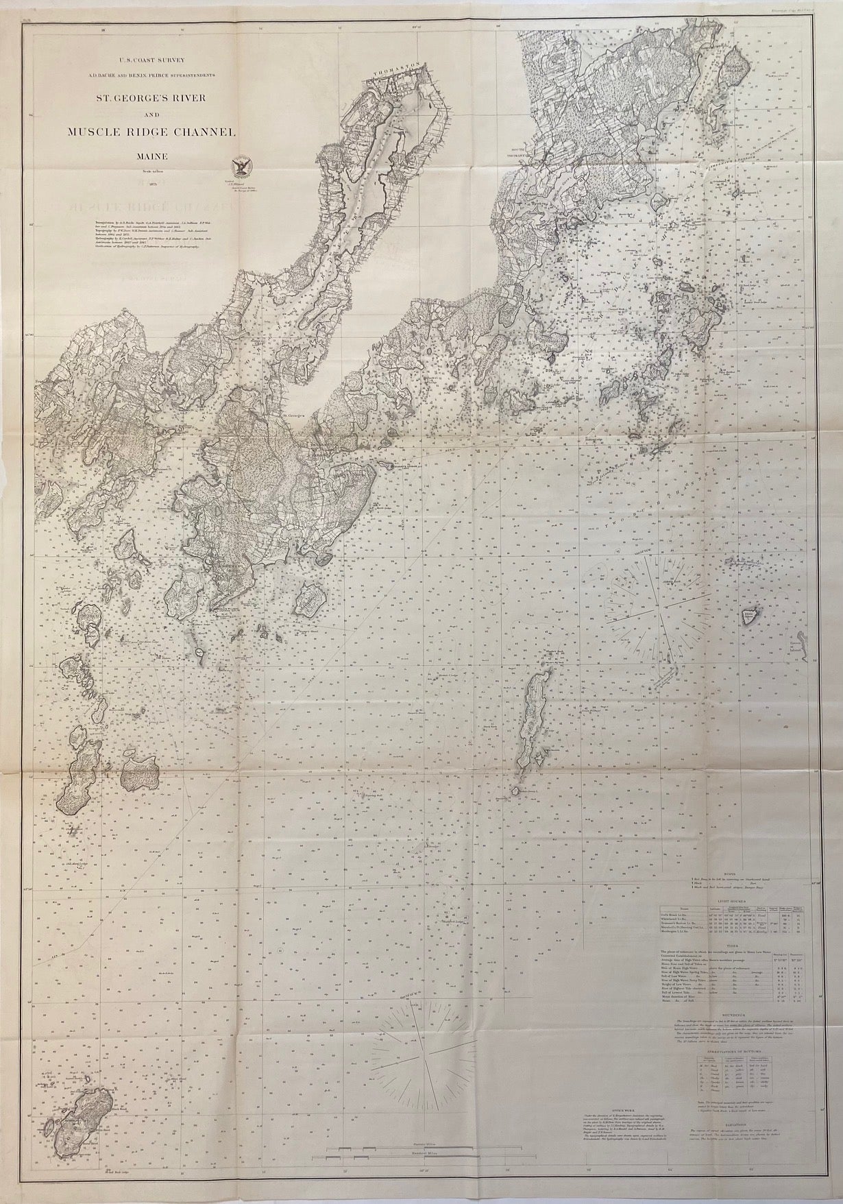
St. George River and Muscle Ridge Channel, Maine
Washington: Government Printing Office, 1873.
Sea chart. Uncolored lithograph. Image measures 38" x 26 1/4"
Detailed sea chart depicting the coastline of Maine from Owls Head to Friendship, including the St. George harbor extending to Thomaston, the Muscle Ridge islands, Monhegan Island, and others. The chart is beautiful and technical, showing surrounding banks, towns, forts and topographical features. In very good condition, with very minor toning along original fold lines, and some offsetting below the title.
Alexander Dallas Bache (1806-1867) was an incredibly prolific surveyor, who worked as the superintendent of the United States Coast Survey.
Binding: Unbound
Language: English
Price: $365.00
Item #312428