
New York
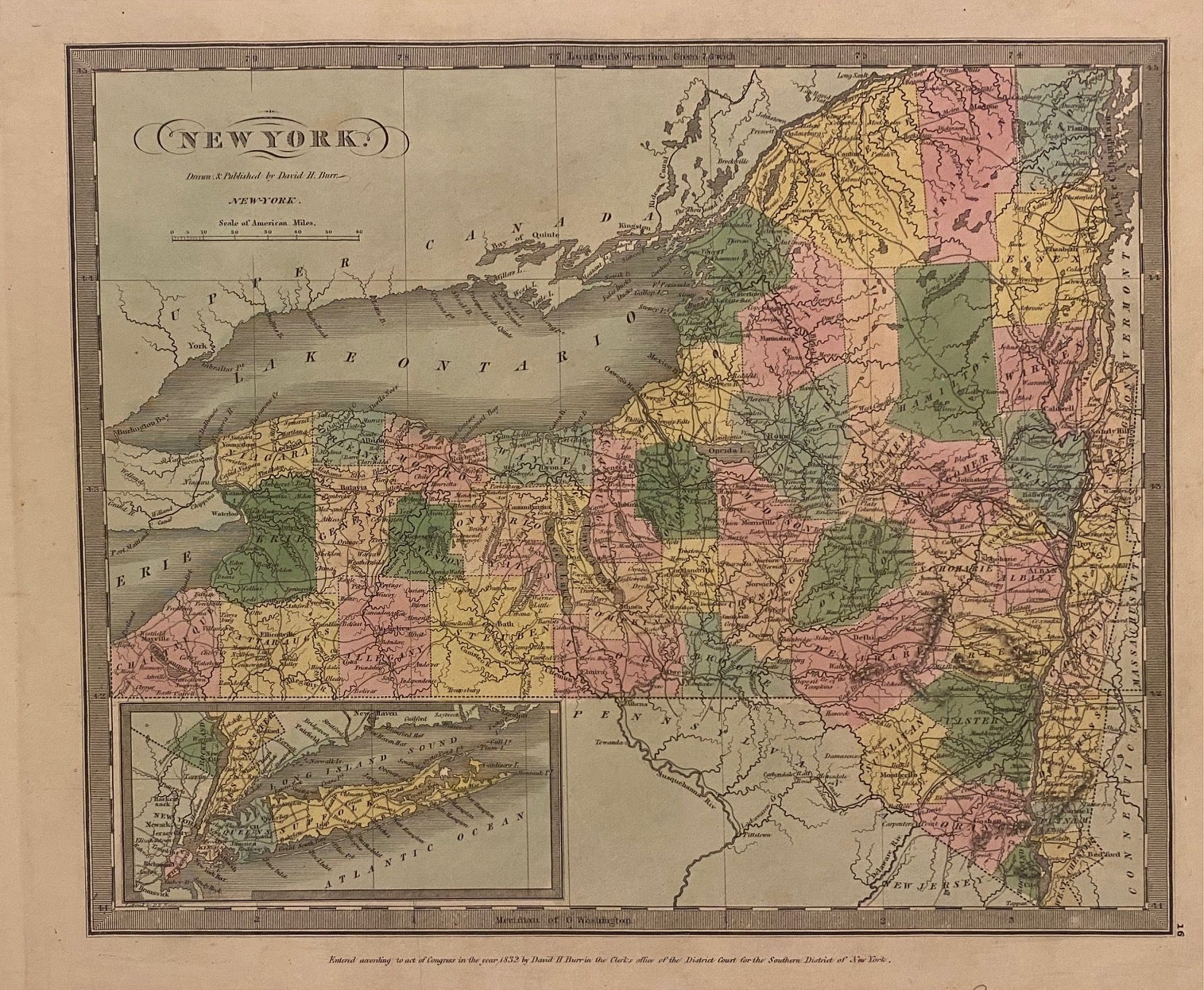
New York: David H. Burr, 1835.
Map. Engraving with original hand coloring. Image measures 10 3/8" x 12 1/4"
Early map of New York, beautifully hand colored to show county divisions. An inset in the lower left corner depicts Long Island and New York City. Cities, towns, major routes, topographical features, islands, and waterways are labeled. In very good condition. Some wear and signs of aging at margins, not affecting the image.
David H. Burr (1803-1875) served as Topographer to the United States Post Office and Geographer to the House of Representatives and was widely known for his accuracy and attention to detail. His "Universal Atlas" was the first to map each of the United States individually.
Binding: Unbound
Language: English
Price: $300.00
Item #312196