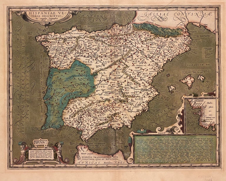
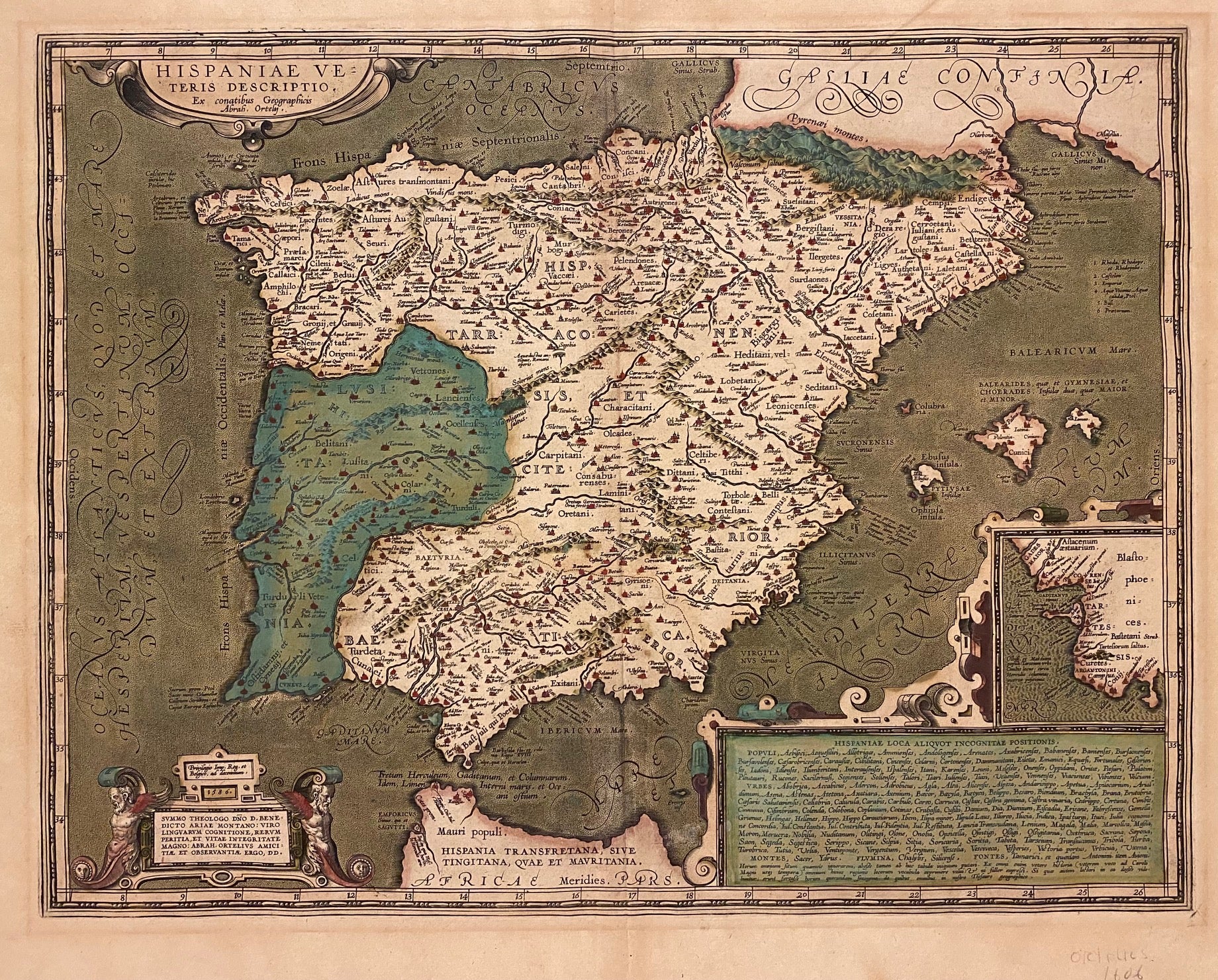
Hispaniae Veteris Descriptio
Antwerp: Abraham Ortelius, 1606.
Map. Engraving with original hand color. Image measures 14 5/8" x 19 1/8"
Beautiful map of Iberia with original color. The map extends from Pyrenees to the northern tip of Morocco. The peninsula is divided into the three Roman provinces of Tarraconsensis, Lusitania, and Baetica. An inset in the right margin depicts the area surrounding the city of Cadiz. A table in the lower right lists towns, cities, mountains, rivers, and sources of the map.
Abraham Ortelius (1527-1598), a Flemish cartographer and geographer, is widely regarded as one of the important and influential cartographers in history. He is known for his "Theatrum Orbis Terrarum," which was the first modern atlas. Van den Broecke #30
Binding: Unbound
Language: Latin
Price: $1,000.00
Item #312067