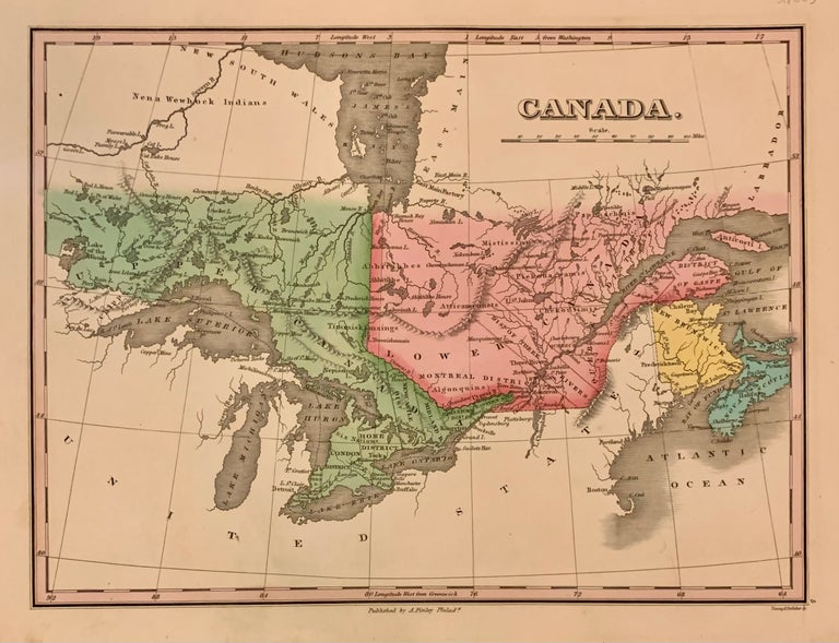
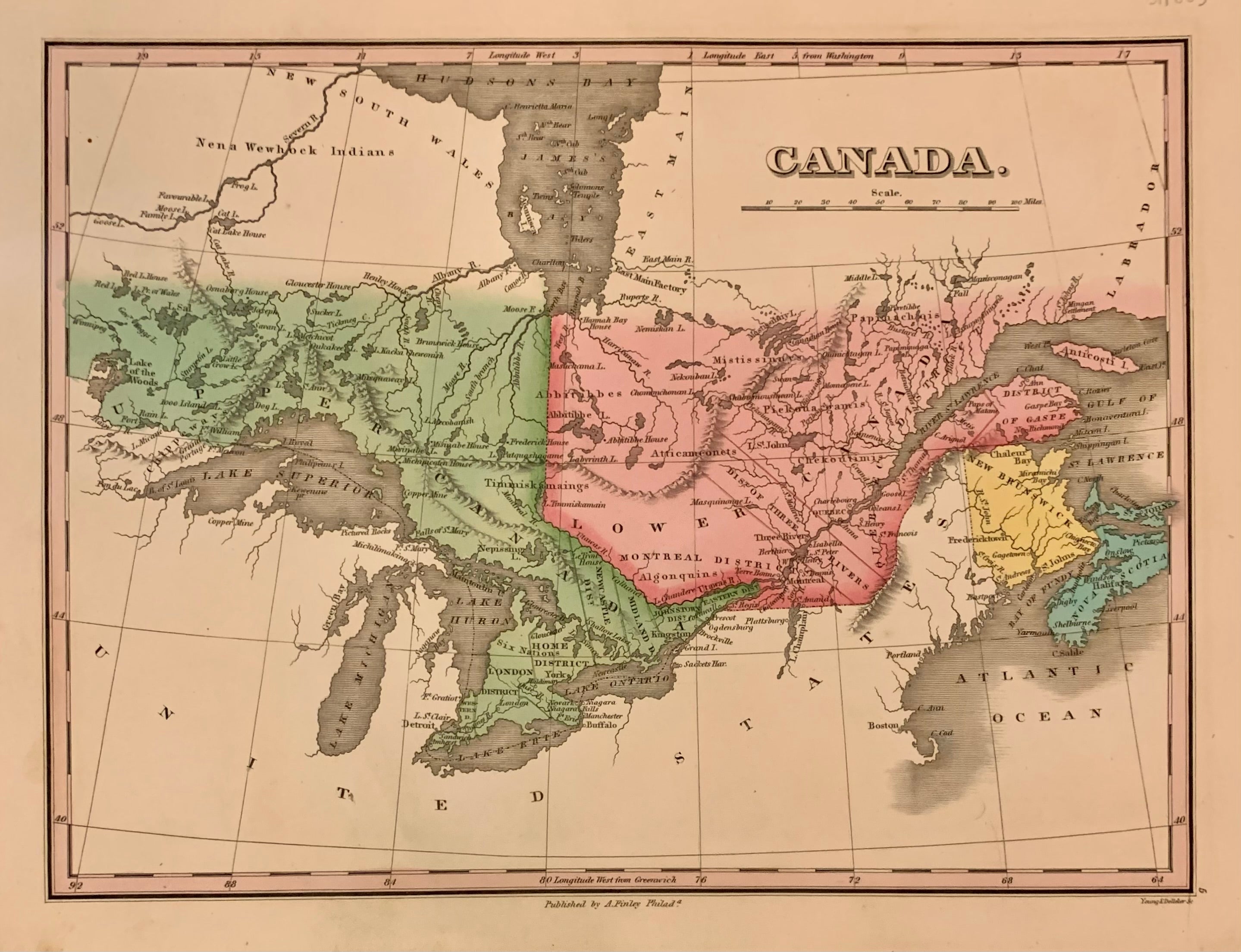
Canada
Philadelphia: Anthony Finley, 1824.
Map. Engraving with original hand coloring. Image measures 9" x 11 1/2"
Beautiful early map of Canada, then known as Upper Canad and Lower Canada, Extending to Winnipeg River. Toronto is still named York, Roads, waterways, islands, geographical features are labeled. Great lakes are all labelled. Extensive notes on Indigenous regions are noted. In very good condition, with extra care taken with the original coloring.
Anthony Finley (c. 1790-1840) was a prominent American cartographic publisher in the early 19th century. He is best known for his "New General Atlas", and "New American Atlas", which were well received and praised for their clearness and accuracy.
Illustrator: Young & Delleker
Binding: Hardcover
Language: English
Price: $135.00
Item #311803