
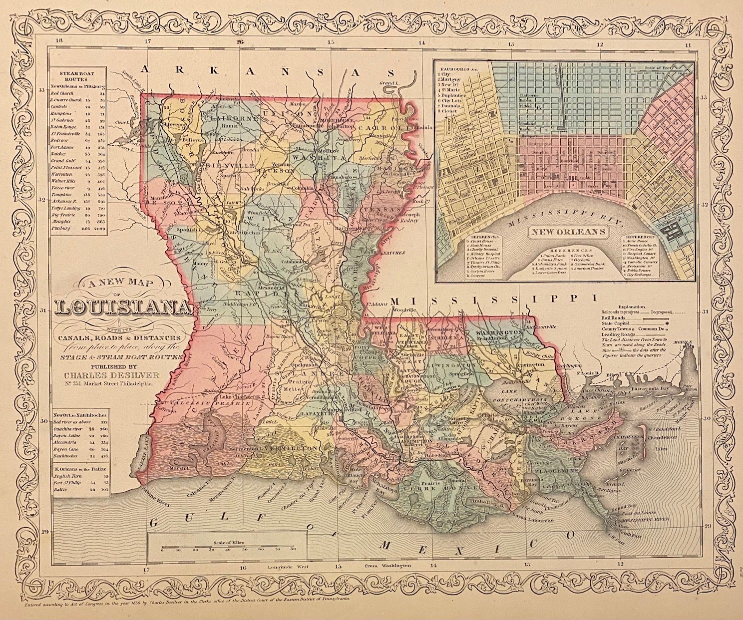
A New Map of Louisiana with its Canals, Roads, & Distances
Philadelphia: Charles Desilver, 1856.
Map. Engraving with original hand coloring. Image measures 14 3/4" x 11 3/4"
Lovely map of Louisiana divided into counties. Shows major cities, major routes, waterways and railroads. Includes inset showing New Orleans. A table in the upper left indicates steam boat routes from New Orleans to Pittsburgh, to Natchitoches, and to Balize. This map was published in Desilver's 1856 edition of the "New Universal Atlas". In excellent condition.
Charles Desilver (fl. 1856-1862) was a Philadelphia based map publisher active in the mid 19th century. He purchased the copyright for Mitchell%u2019s %u201CNew Universal Atlas%u201D, publishing his own editions in 1856 and 1857. The maps from these editions were updated with the most recent information, especially related to roads, canals, and railways.
Binding: Unbound
Language: English
Price: $265.00
Item #311442