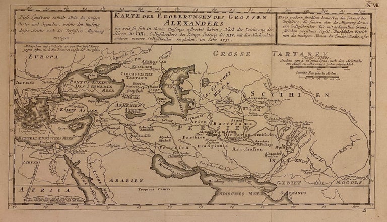
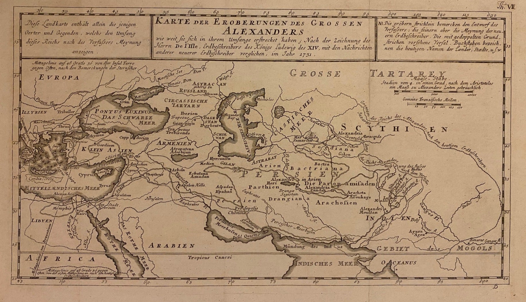
Karte der Eroberungen des Grossen Alexanders
Paris: J. Senex, 1705.
Map. Engraving with hand coloring. Image measures 7 1/2" x 13 5/8"
Beautiful classical map of the Middle East showing the extent of Alexander the Great's conquests. Centered on Persia, the maps spans the vast region from the Tyrrhenian Sea to the Ganges River. Text in German.
Guillaume Delisle (1675-1726) was a legendary French cartographer known for introducing a new standard of accuracy into 17th-century mapmaking. He was one of the cartographers who propelled the French school of map-making away from Dutch dominance. The French school emphasized science and accuracy over ornament. His family took over the business and kept publishing maps well into the late 18th century. He used astronomical observations to determine locations and draw more precise coastlines. He continually updated his maps and dispelled prevailing geographical inaccuracies throughout his life.
John Senex (1678-1740) was a kind of Renaissance man of the 18th-century map world, working at times as a scholar, surveyor, engraver, astrologer, book seller and publisher of maps, atlases and globes. In a short period, he developed from an apprentice into one of the most important cartographers of the period and became a Fellow of the Royal Society of London, as well as Official Geographer to Queen Anne of Great Britain. Although well regarded for his pocket-size maps, Senex is probably best known for his globes, which display a knowledge of astronomy equal to the skill of their craftsmanship. After his death in 1740 his wife Mary continued his business and continued to produce and sell cartographic works of high quality. Together, their work represents a successful and valuable partnership in 18th-century mapmaking and publishing.
Binding: Unbound
Language: German
Price: $100.00
Item #310838