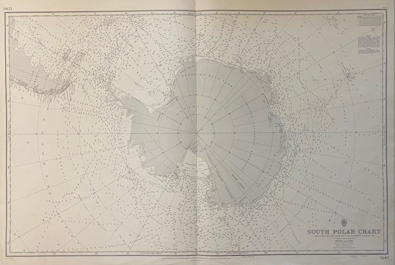
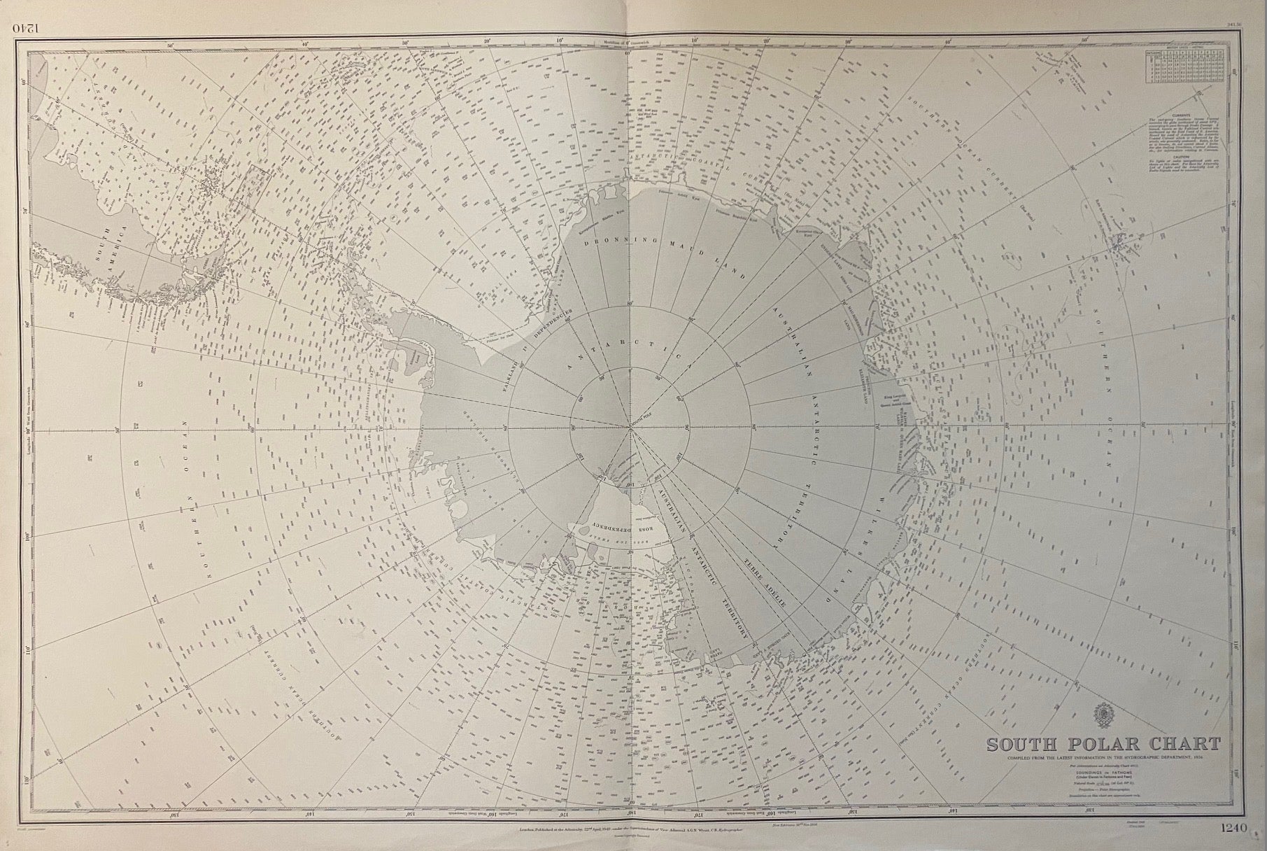
South Polar Chart
London: British Admiralty, 1956.
Map. Lithograph. 27 1/2" x 40 1/2"
Large nautical chart of Antarctica and surrounding oceans, centered on the South Pole. Rendered on a polar stereographic projection, the map was compiled from data by the British Hydrographic Department, updated with corrections in 1956. Features soundings in fathoms. Coastlines are carefully rendered, showing seasonal fluctuations and ice shelves. Includes the southern tip of South America, the Falkland Islands, South Georgia and the South Sandwich Islands, and the Crozet and Kerguelen Islands. In very good condition. Pinholes at corners. Several stamps dated 1957-1963 on verso, by the chart department of Lilley & Reynolds, Ltd., a manufacturer and supplier of marine navigational equipment. Minor wear to edges but overall clean with no chips or tears.
Binding: Unbound
Language: English
Price: $475.00
Item #310676