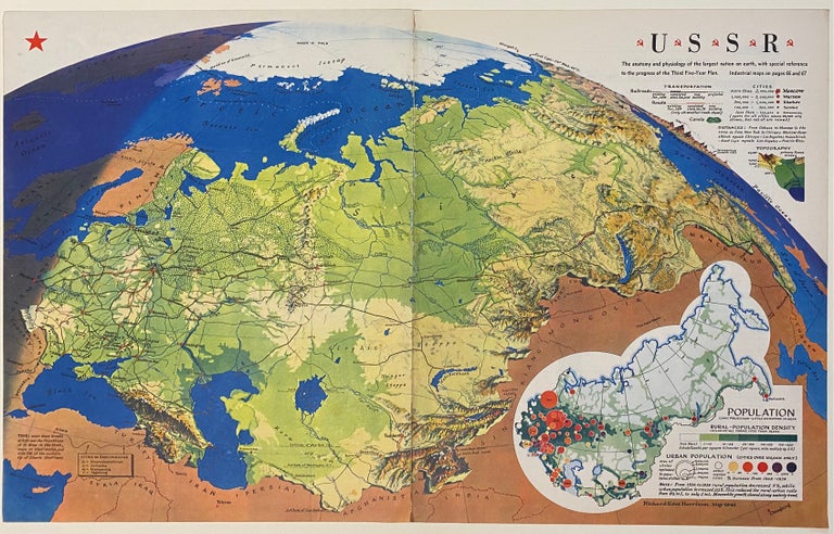
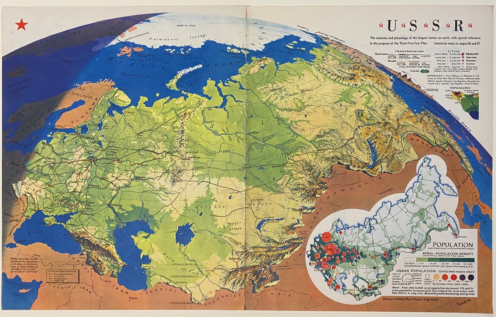
U.S.S.R.
New York: Fortune, 1941.
Original map. Color Lithograph. 13 7/8" x 22 3/8"
Artistically rendered map of the Soviet Union drawn by Richard Edes Harrison in May 1941. The map is drawn on a globular projection, with the terminator line (or twilight zone) depicted along the eastern border with Germany, with a notation describing the time of day - "when dawn breaks at 5:30 over the Carpathians, it is 8:00 in the Urals, noon at Vladivostok, and 4:30pm at the eastern tip of Siberia." Harrison's use of coloring beautifully illustrates the region's topography, enhanced by pictorial detail showing forested areas and snow-covered peaks. Railroads, roads, canals, and cities are labeled. In the lower right, an inset maps show major population centers, density, and urban population growth between 1926 and 1939. Intended for an American audience, Harrison includes the latitude lines of Cape Hatteras, Washington D.C., New York City, and Montreal/Portland, OR for comparison. In very good condition. Minor toning at edges and along fold, barely noticeable.
Richard Edes Harrison (1901-1994) was a prominent American cartographer and designer. He was well-known for his innovative approach to perspective and projection; his skills in visualization and graphic design transformed the field of map-making into an important storytelling tool and a way to make spatial information more accessible to the public.
Language: English
Price: $285.00
Item #310660