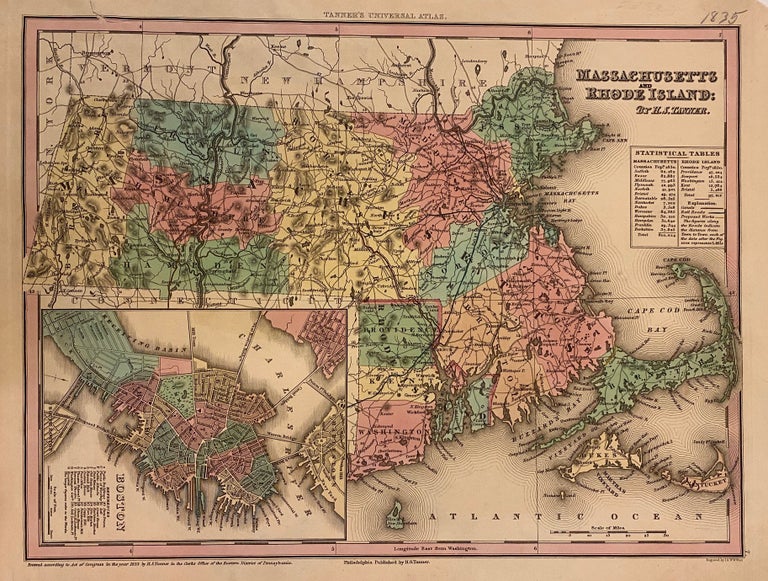
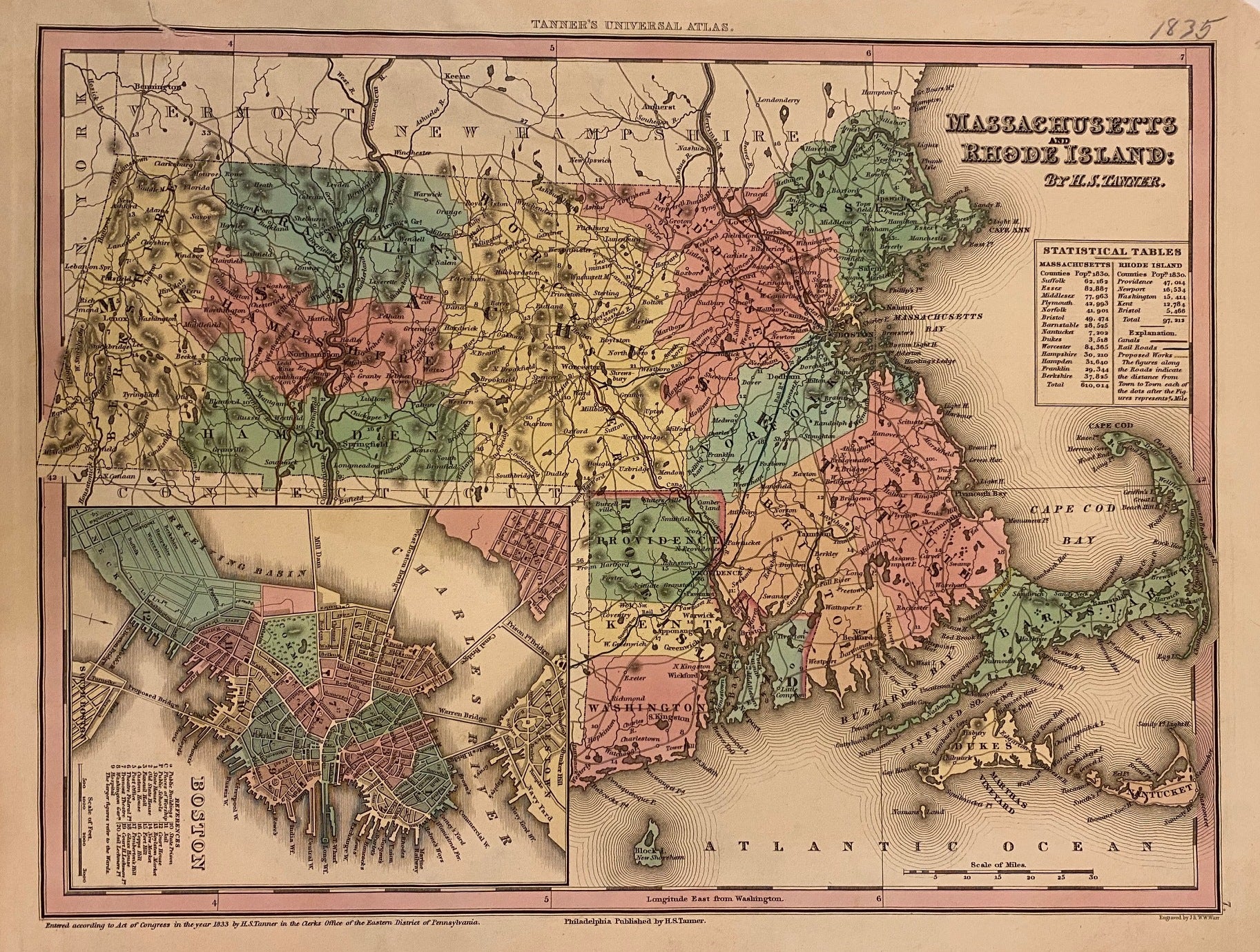
Massachusetts and Rhode Island
Philadelphia: H.S. Tanner, 1835.
Map. Engraving with hand coloring. Image measures 11" x 14 1/4"
Classic map of Massachusetts and Rhode Island divided into counties and townships. Shows towns, waterways, major routes and geographic features. Railraods are delineated by hand in blue, canals in orange, and proposed works in yellow. Includes statistical tables in the upper right listing counties with their respective populations. An inset in the lower left features a town plan of Boston, colored to show wards, and with 20 points of interest labeled. Previously mounted on paper, with some still attached to verso. This map is in very good condition, with one closed tear to the upper right corner.
Henry Schenck Tanner (1786-2858) was an American cartographer and statistical geographer. Born in New York, he moved to Philadelphia where he established his well-known publishing company with his brother. Tanner is widely considered the first native-born American publisher devoted expressly to maps. He is best known and most renowned for his New American Atlas.
Binding: Unbound
Language: English
Price: $235.00
Item #310641