Boston
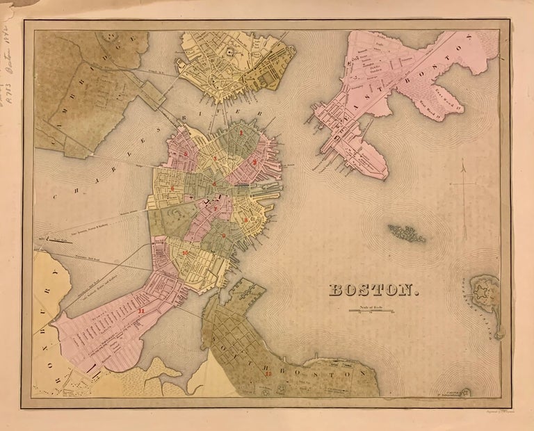
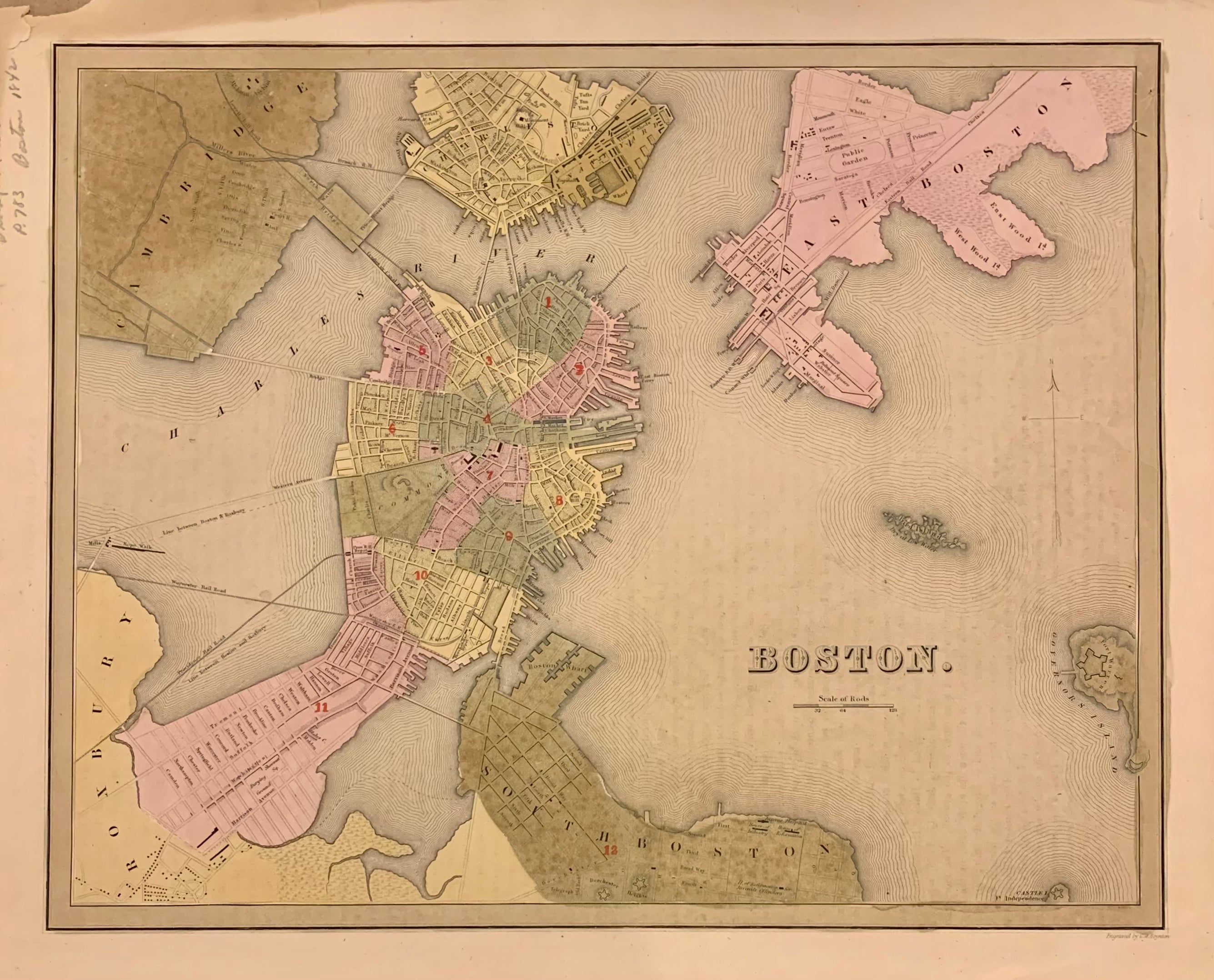
Boston: T.G. Bradford, 1838.
Map. Engraving with original hand coloring. Image measures 11 3/8" x 14 1/8".
Beautiful early map of Boston and parts of Cambridge, Brookline, Charlestown, East and South Boston. Showing wards, streets parks, railroads and notable landmarks. Light scattered foxing, stain and minor wear to upper right corner, with stains to margins and some offsetting.
Thomas Gamaliel Bradford (1802-1887) was a Boston based publisher. He worked as assistant editor of the American Encyclopedia before entering the field of map making. He was best known for his important contributions to American cartography, the 1838 "Illustrated Atlas Geographical, Statistical and Historical of the United States and Adjacent Countries."
Illustrator: G.W. Boynton
Binding: Unbound
Language: English
Price: $300.00
Item #310562