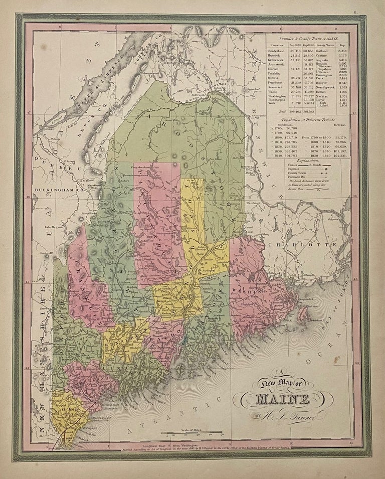
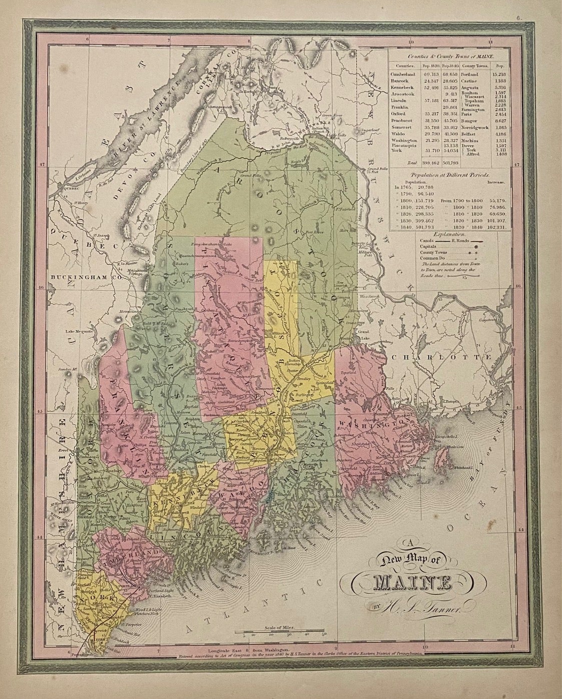
A New Map of Maine
Philadelphia: S. Augustus Mitchell, 1846.
Map. Engraving with hand coloring. Image measures 14 1/2" x 11"
Lovely map of Maine divided into counties and townships. Shows towns, waterways, major routes and geographic features. Originally published by Tanner in 1833, this is State VIII of this map - the last to bear Tanner's name in the title, and the first to be published by S. A. Mitchell (although his name was not yet printed). Includes tables in the upper right corner listing counties and towns with their respective populations, and showing population growth in the state from 1765 to 1840. Aroostook County is shown with its final boundaries, following its annexation of northern parts of Piscataquis, Somerset, and Penobscot Counties in 1846. While the map is colored to the boundary line of 1842, evidence of the Northeastern Boundary Controversy with Great Britain is visible with the northern part of the state showing various boundary lines, including the line claimed by Great Britain, the boundary according to the Treaty of 1783, and the line as proposed by the King of the Netherlands. (Thompson 78) This map is in very good condition, with minor overall toning and faint spotting.
Henry Schenck Tanner (1786-2858) was an American cartographer and statistical geographer. Born in New York, he moved to Philadelphia where he established his well-known publishing company with his brother. Tanner was the first American to publish a map of Texas, which subsequently went through eight editions. However, he is best known and most renowned for his New American Atlas.
Binding: Unbound
Language: English
Price: $250.00
Item #310415