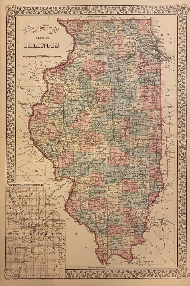
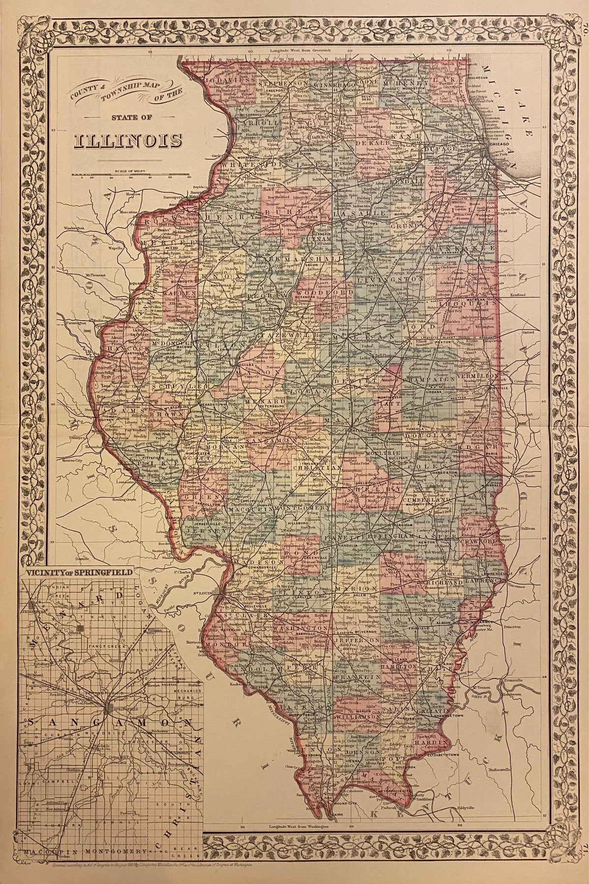
County & Township Map of the States of Illinois
Philadelphia: Mitchell, Samuel Augustus Jr., 1882.
Map. Engraving with original hand coloring. Image measures 21 1/4" x 14 1/8"
Beautiful double-page map of Illinois divided into counties. Showing townships, towns, major routes, waterways and railroads. Features an inset of the vicinity of Springfield, the state's capital. Plan of Cincinnati on verso. In excellent condition. Original centerfold as issued.
Samuel Augustus Mitchell Sr. (1792-1868) was one of the leaders in American cartography of the 19th century and pioneered the conversion of engraved map plates to more affordable lithographic plates. His son, Samuel Augustus Mitchell Jr. continued his father's successful mapmaking and publishing business, and was one of the most prolific and renowned 19th century American publishers.
Illustrator: Gamble, W.H.
Binding: Unbound
Language: English
Price: $125.00
Item #310367