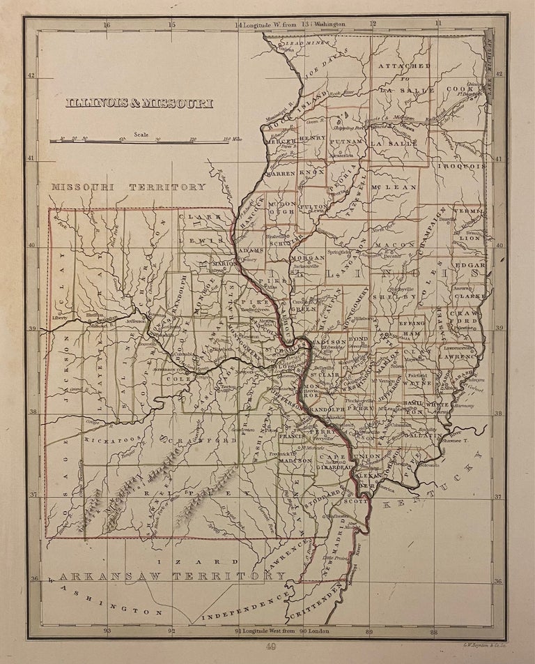
Illinois & Missouri
Boston: Bradford, Thomas Gamaliel, 1835.
Map. Engraving with original outline coloring. Image measures 10" x 8".
Charming map of Illinois and Missouri, divided into counties. Shows town, geographical features and Indian tribes. Light scattered foxing.
T.G. Bradford (1802-1887) was a Boston based publisher. He worked as assistant editor of the American Encyclopedia before entering the field of map making. He was best known for his 1835 "A Comprehensive Atlas: Geographical, Historical & Commercial" and his 1838 "Illustrated Atlas Geographical, Statistical and Historical of the United States and Adjacent Countries", both of which proved to be important contributions to American cartography.
Binding: Unbound
Language: English
Price: $75.00
Item #310356