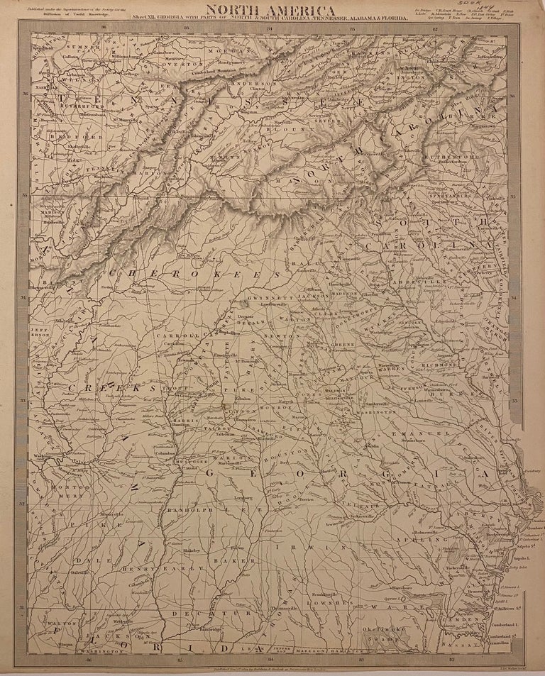
North America Sheet XII. Georgia with Parts of North & South Carolina, Tennessee, Alabama & Florida
London: Baldwin & Cradock, 1844.
Map. Uncolored engraving. Image measures 15 3/8" x 12.5".
Nicely detailed map of Georgia with parts of surrounding states. Delineates counties, major cities and waterways. Topography is beautifully rendered by hachure. Interestingly, this map shows territories occupied by the Cherokee and Creek Indians, despite their forced removal several years before the publication date. Native American villages are depicted with a tee-pee symbol, settler towns with a circle, and forts with a star-like symbol. Many villages are labeled, including Etowah, a prehistoric site established around 1000 A.D. and inhabited by the Cherokee from the late 18th century. New Echota is also labeled, and was the capital of the Cherokee Nation until their forced removal in 1938.
The Society for the Diffusion of Useful Knowledge was formed in 1826 and published low cost maps with the goal of reaching a large market, while still maintaining high quality and precision.
Illustrator: J. & C. Walker
Binding: Unbound
Language: English
Price: $200.00
Item #310353