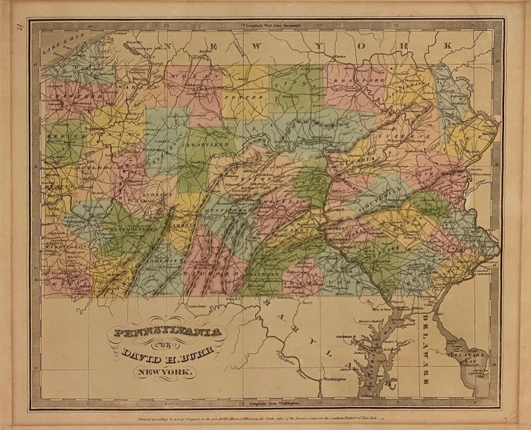
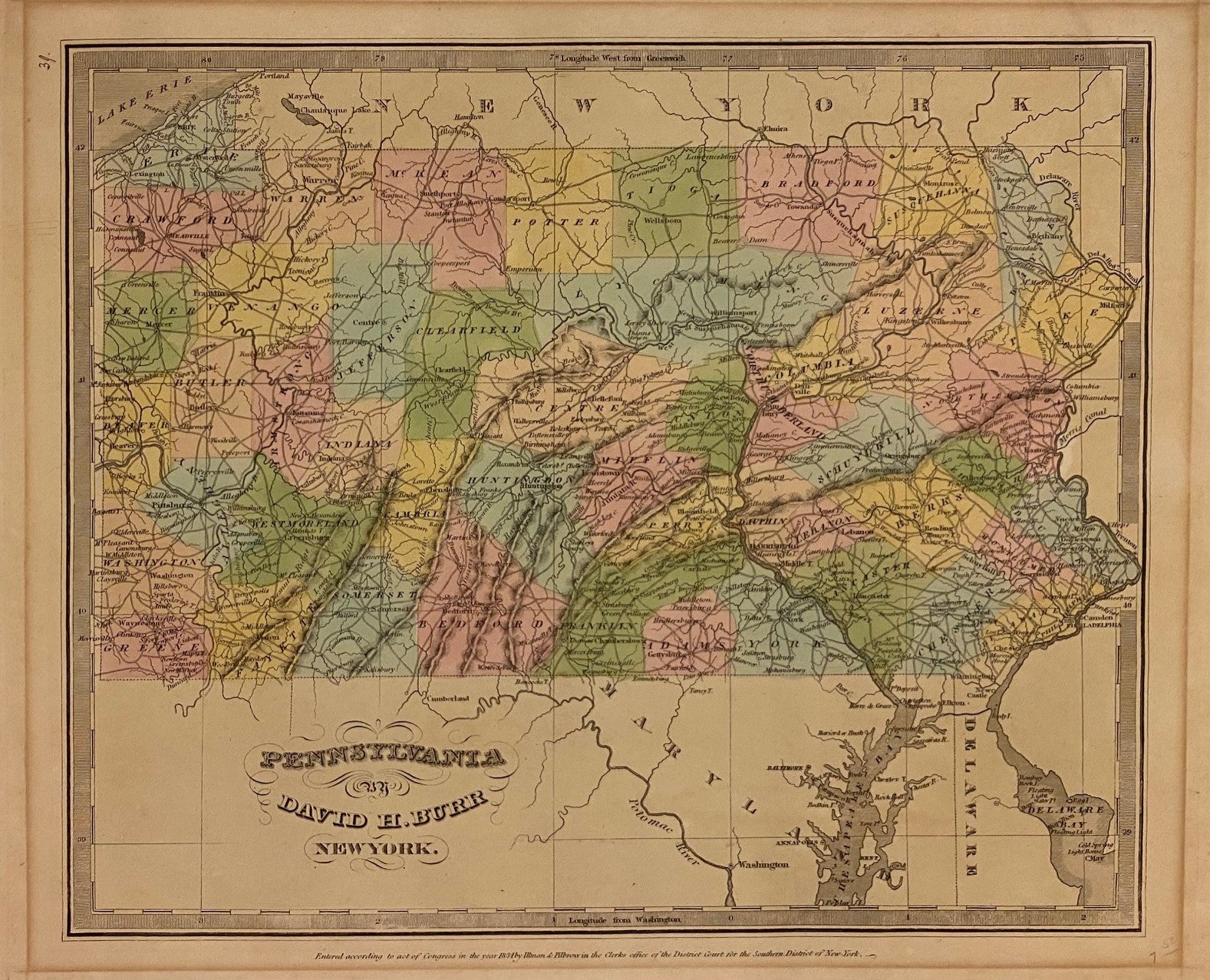
Pennsylvania
New York: Illman and Pilbrow, 1834.
Map. Engraving with original hand coloring. Image measures 10 1/2" x 12 5/8"
Early map of Pennsylvania, beautifully hand colored to show county divisions. Cities, towns, major routes, topograhical features, islands, and waterways are labeled. In very good condition. Mat burn to margins.
David H. Burr (1803-1875) served as Topographer to the United States Post Office and Geographer to the House of Representatives and was widely known for his accuracy and attention to detail. His "Universal Atlas" was the first to map each of the United States individually.
Illustrator: Thomas Illman
Binding: Unbound
Language: English
Price: $200.00
Item #310002