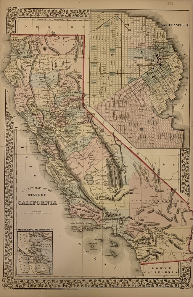
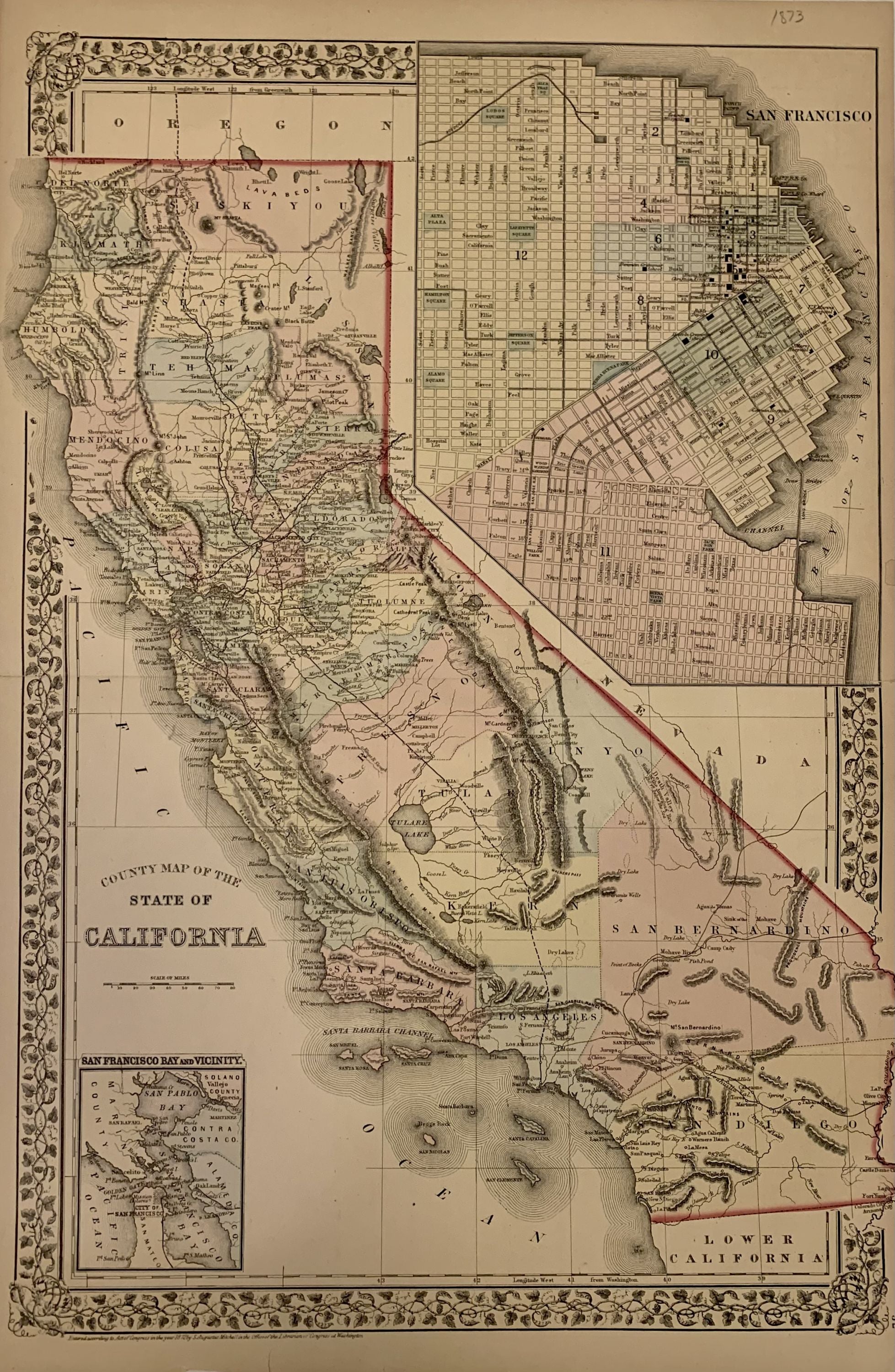
County Map of the State of California
Philadelphia: Mitchell, Samuel Augustus Jr., 1873.
Map. Steel engraving with original hand coloring. Image measures 21 1/4" x 14 1/2 inches.
Beautifully detailed double page map of California divided into early county borders, showing major towns and cities, routes, railroads and waterways. Includes two insets of San Francisco-one the bay and its vicinity and the other a city plan. Chips to margins, otherwise in good condition. Plate 52 in margin.
Samuel Augustus Mitchell Sr. (1792-1868) was one of the leaders in American cartography of the 19th century and pioneered the conversion of engraved map plates to more affordable lithographic plates. His son, Samuel Augustus Mitchell Jr. continued his father's successful mapmaking and publishing business, and was one of the most prolific and renowned 19th century American publishers.
Binding: Unbound
Language: English
Price: $235.00
Item #309740