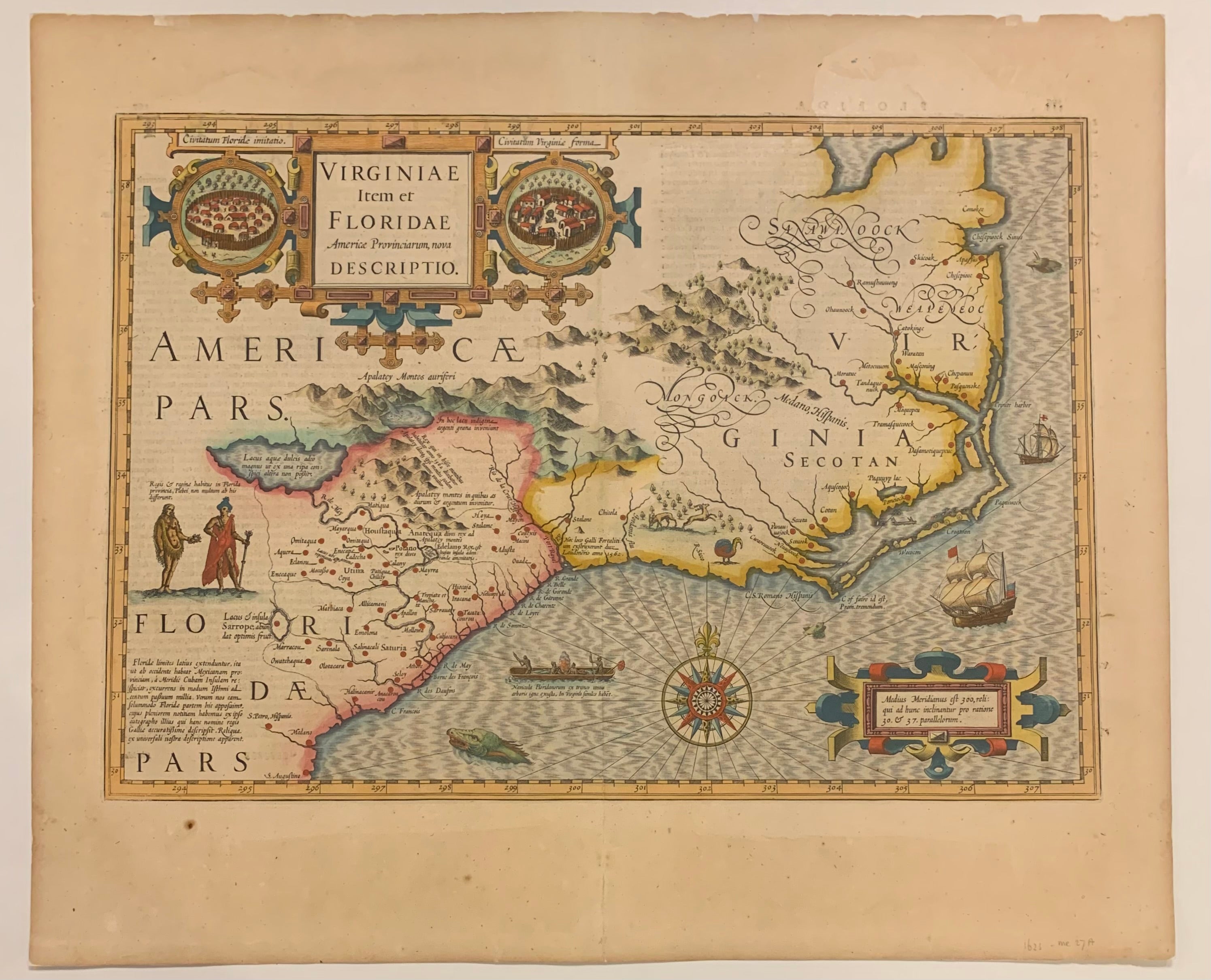
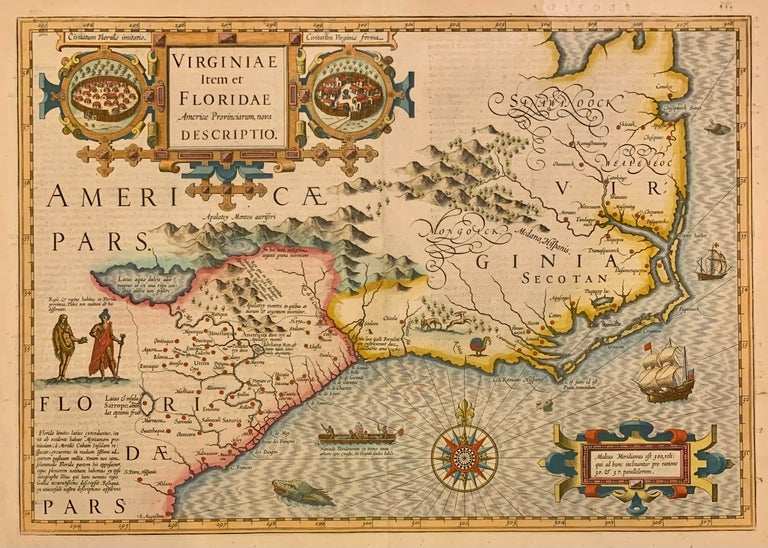
Virginiae Item et Floridae Americae Provinciarum nova Descriptio.
Amsterdam: Jodocus Hondius, 1623.
Map. Engraving with hand coloring. Image measures 13 3/8" x 19".
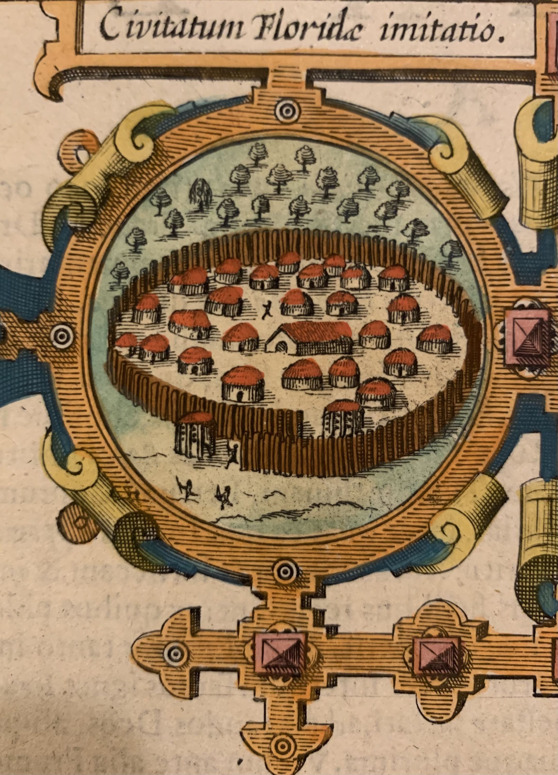
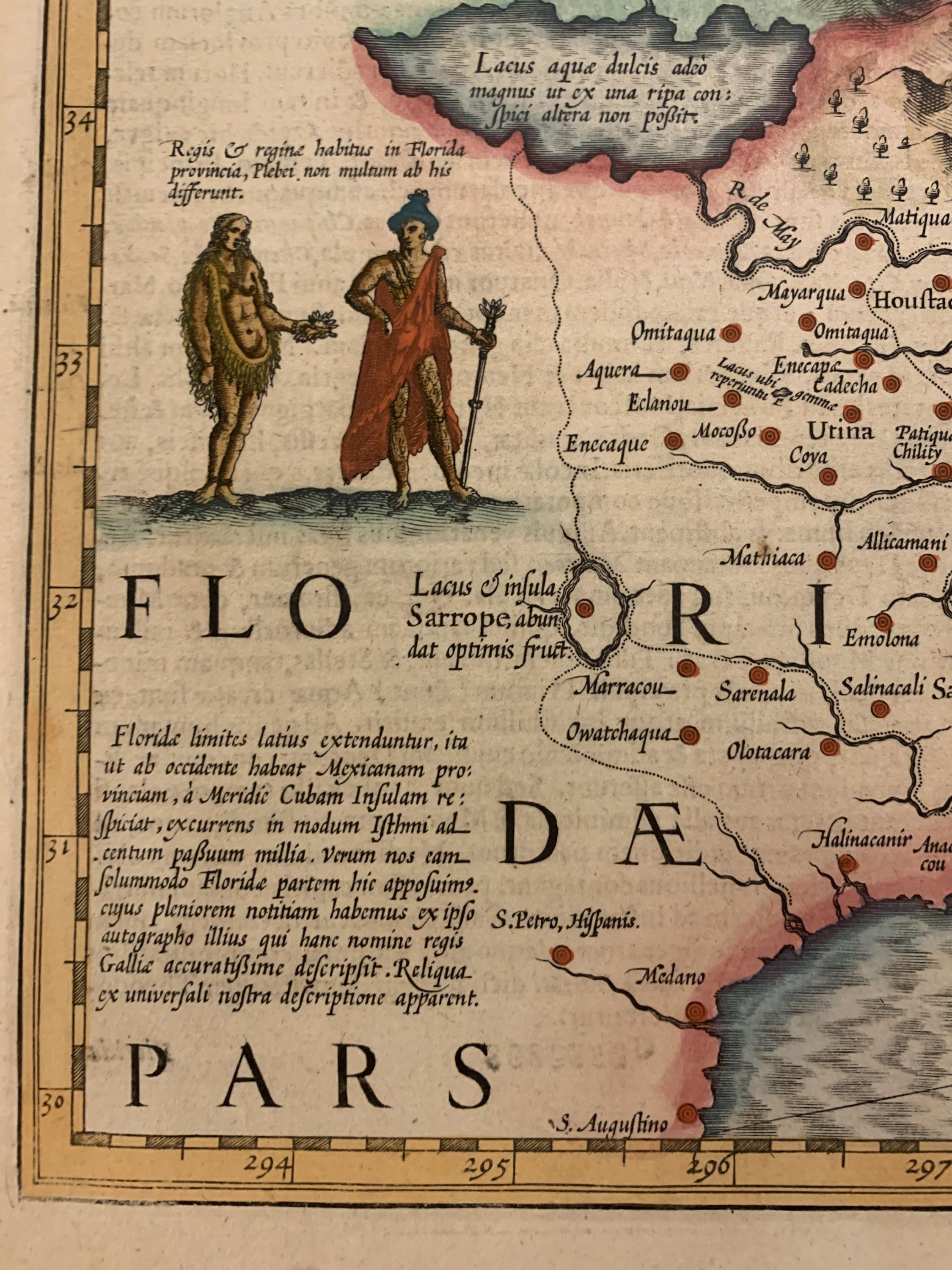
Beautiful early map showing the coastal region from the Chesapeake Bay to northern Florida. Finely engraved to include ships and sea monsters in the ocean with giant title cartouche. Indigenous portraits and marine architecture described, along with animals and wonderfully depicted topographical features in the interior. Title cartouche is flanked by two Native American settlements. Based upon the late 16th century cartographic sources of John White and Jacques le Moyne, the southern coast is quite skewed. Notable place names include the Appalachian Mountains and St. Augustine. Mercator's famous moire pattern in the sea is used. In good condition with some toning and stains in margin not affecting the image. From the 1623 Latin edition of "Gerardi Mercatoris Atlas sive Cosmographicae" (Mercator-Hondius Atlas). Originally created by Mercator, this plate was later added to by Hondius. Jodocus Hondius (1563-1612) was a prolific 17th century Dutch mapmaker who purchased Mercator's plates in 1604. Burden 151
Binding: Unbound
Language: Latin
Price: $2,800.00
Item #309372