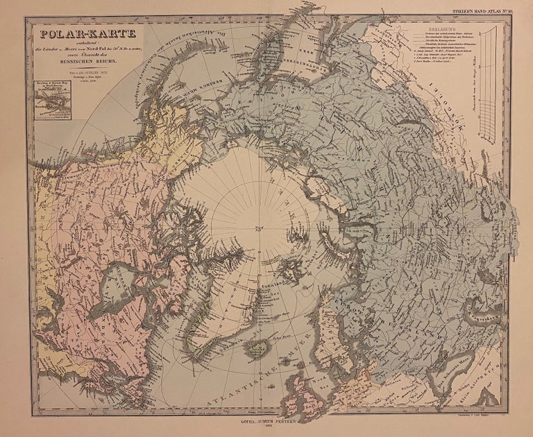
Polar-Karte
Gotha: Justus Perthes, 1877.
Map. Steel engraving with original hand coloring. Image measures 13 1/2" x 15 1/2"
This striking 1877 map was published by Justus Perthes for Stieler's Hand Atlas. Centered on the North Pole, the map depicts northern Europe, Russia, Canada, Alaska and Greenland. Coastlines and island groups are extensively labeled, as are important cities, lakes, rivers, mountains, and other topography. Text in German.
This map appeared in the 1877 issue of Stieler's Hand Atlas. In excellent condition.
The publishing firm of Justus Perthes (1749-1816) was first established in 1785 and continued producing maps up through the beginning of the 21st century. Originally known for almanacs and yearbooks, the firm was nationalized by the German Democratic Republic in the 1950s and channeled its informational bent into the production of school atlases and wall maps. Along with important editors like Peterman, Stieler, Meyer and Spruner, the firm pioneered the Hand Atlas. The Perthes firm continues to publish atlases and maps even today. This map nicely conveys the rigor of their research and production.
Binding: Unbound
Language: German
Price: $165.00
Item #309362