
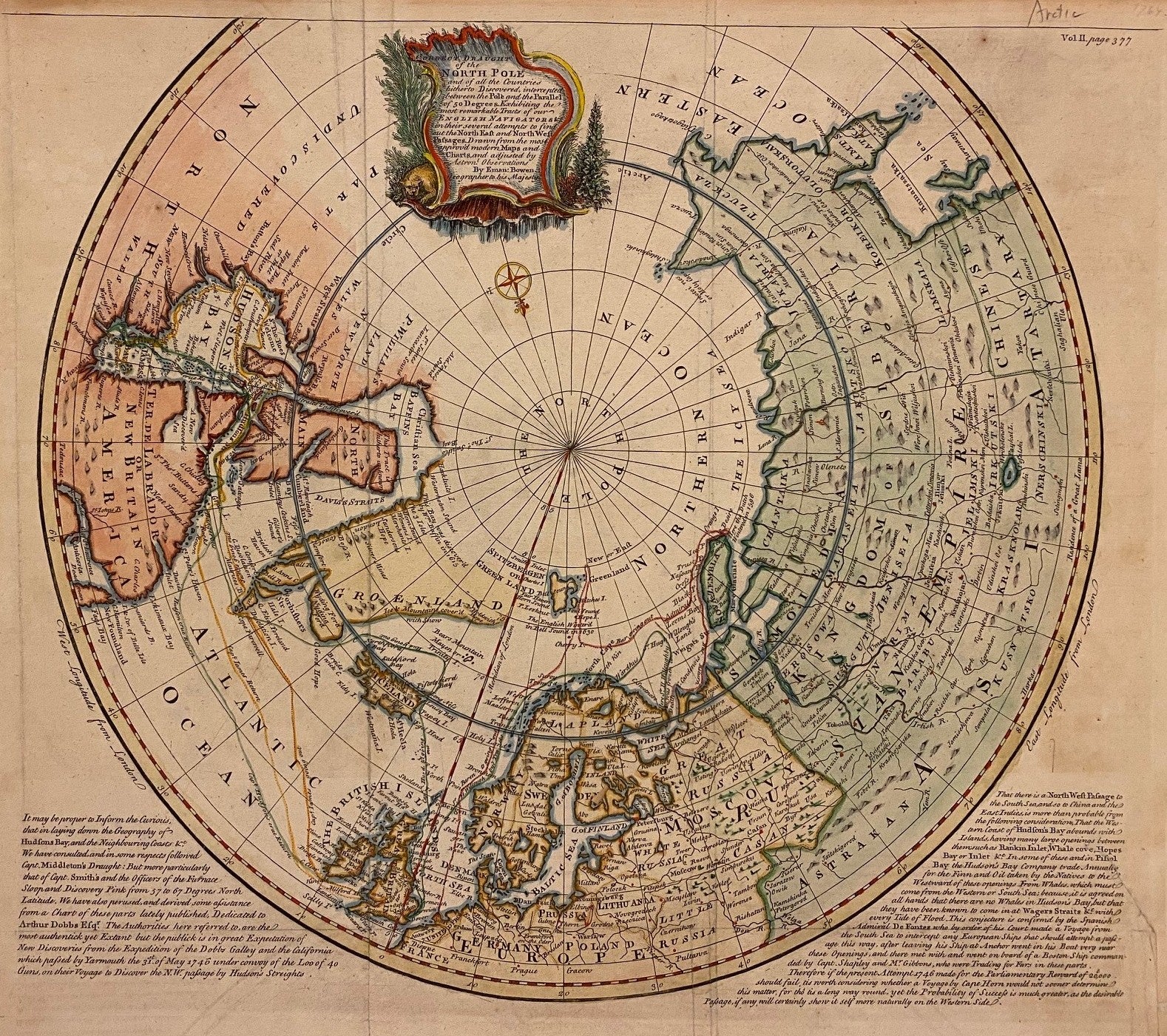
A Correct Draught of the North Pole and of the countries hitherto Discovered...
London: Bowen, Emanuel, 1764.
Map. Hand colored engraving. Image measures 14 9/16" x 17 5/16".
Scarce antique map of the North Pole printed in 1764. Centered on the article circle, the projection extends to the 50th degree of latitude, showing the Eastern half of Canada, Northern Europe, parts of Russia, and Siberia. Surrounding text Overall foxing and toning, minor wear and chipping to edges with repair into lower right text, otherwise in good condition. Explorer routes rendered and mention that 'the Northwest passage is more than probable...'
Emanuel Bowen (1714-1767) was an English map engraver who served as Royal Mapmaker to George II of England and Louis XV of France. He was well-regarded for his large, detailed, and accurate maps.
Binding: Unbound
Language: English
Price: $850.00
Item #309173