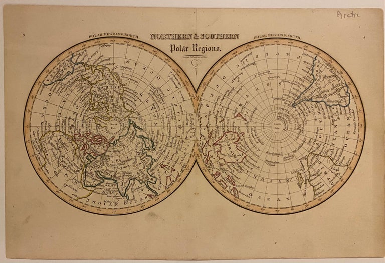
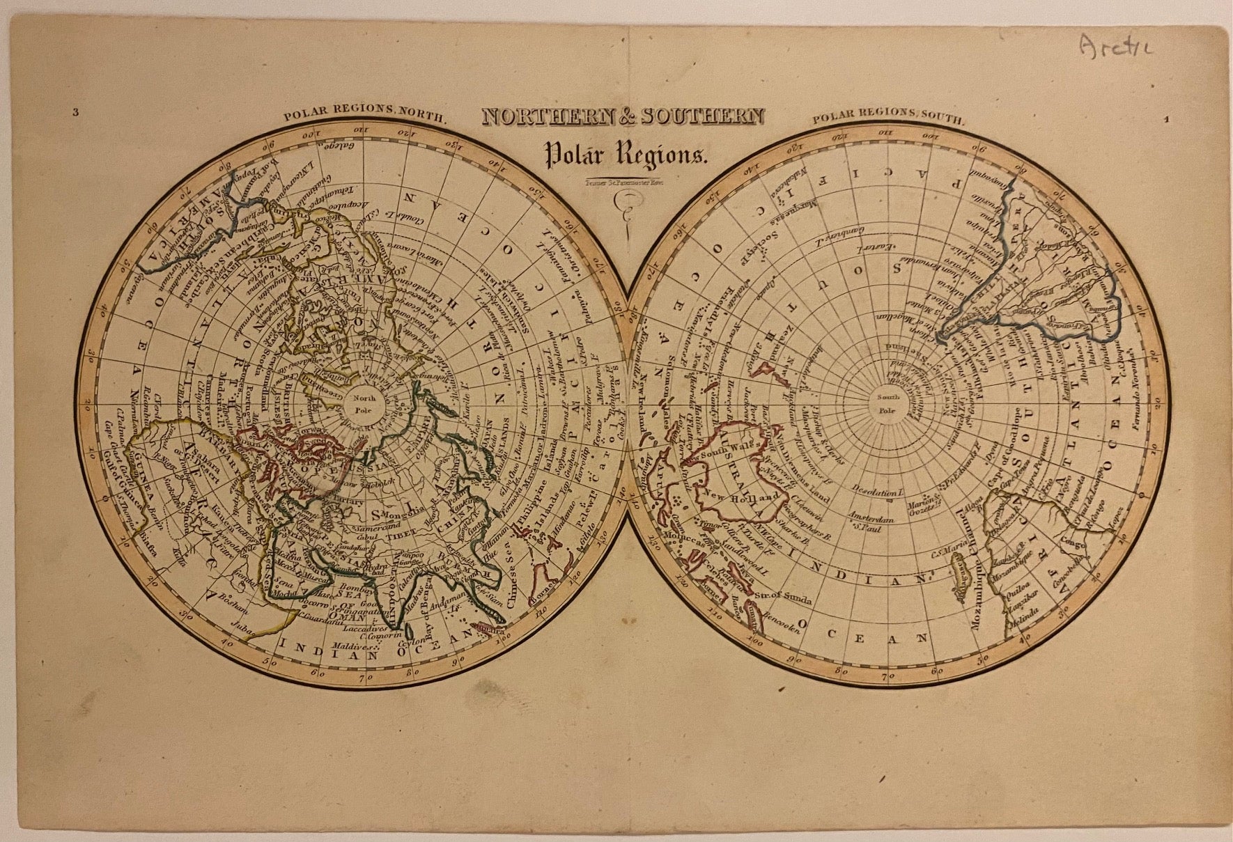
Northern & Southern Polar Regions
London: Joseph Thomas, 1836.
Map. Original engraving with hand colored outline. London: Joseph Thomas, 1835. Measures 6 1/2" x 10"
This small double-hemisphere map depicts the North and South Poles. Incredibly detailed for its size, the map labels regions, cities, rivers, islands, and bodies of water. Antarctica is not depicted, with the exception of a small stretch of coastline labeled Palmer's Land - named for the Capt. Nathaniel Palmer who explored this part of the Antarctic Peninsula in 1820, just sixteen years before this map was published. This map is in very good condition.
Illustrator: FENNER, Rest
Language: English
Price: $325.00
Item #309116
See all items by Joseph THOMAS