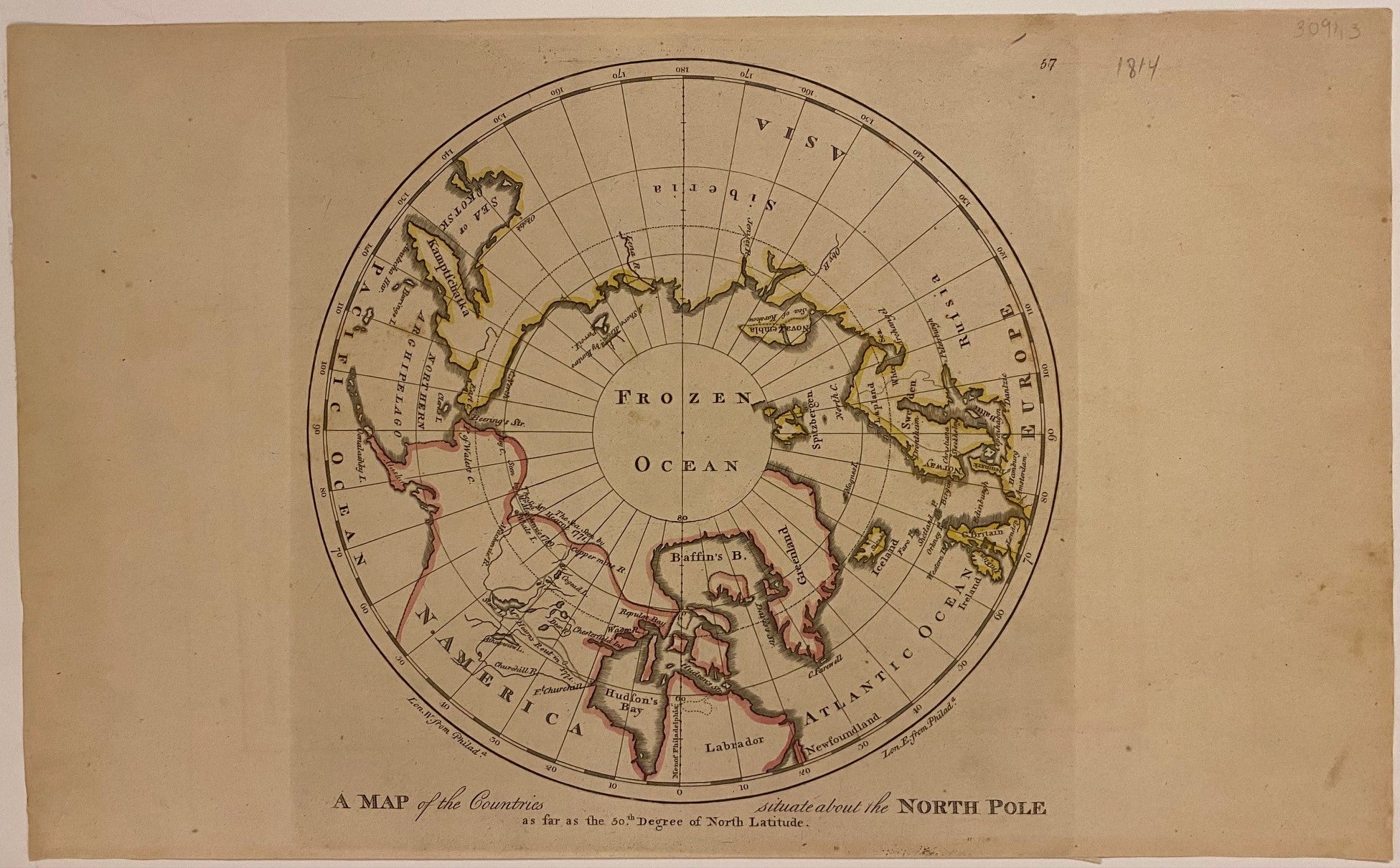
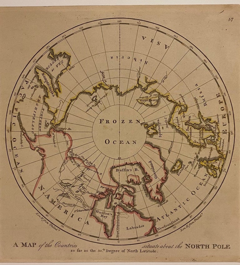
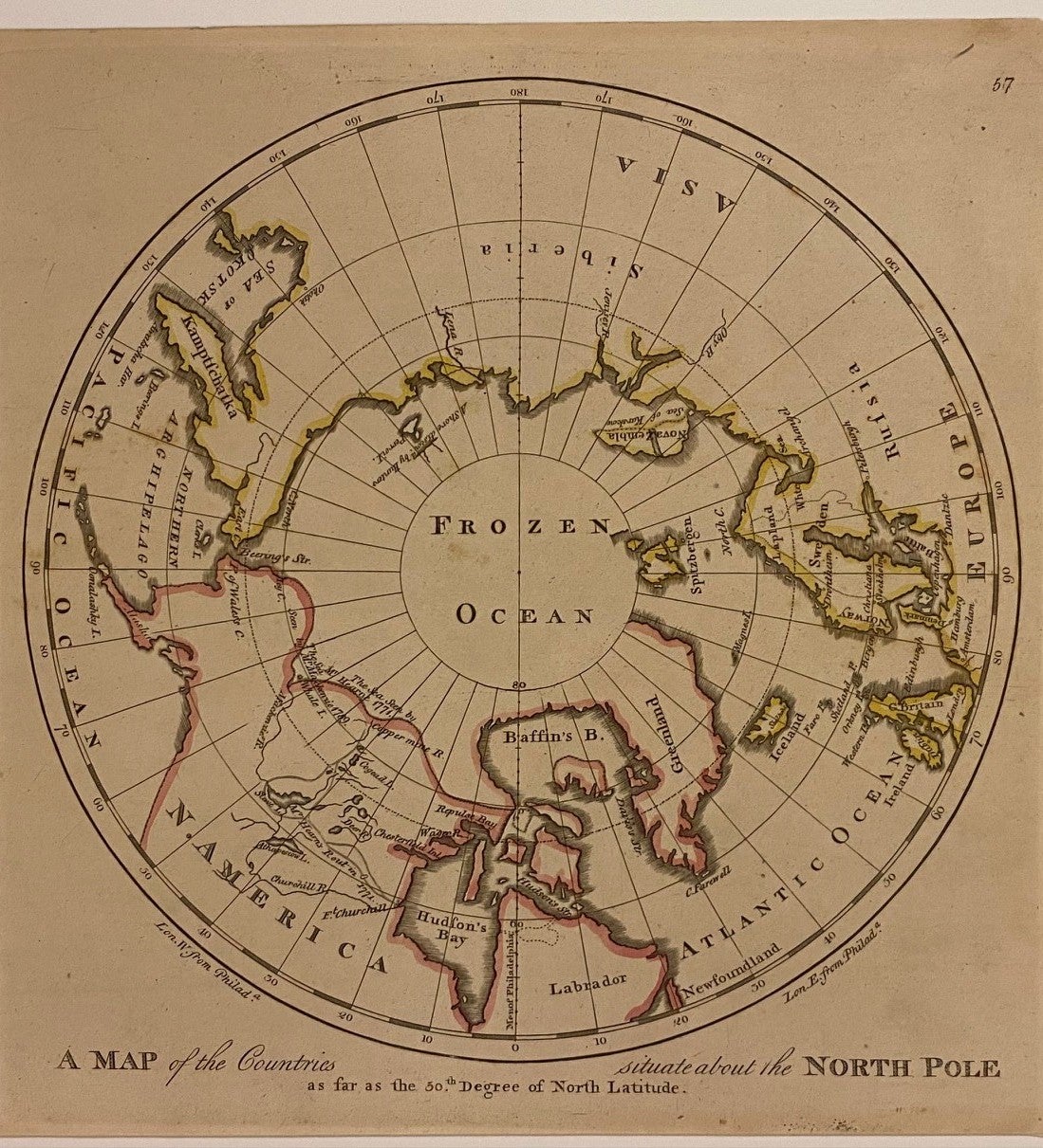
A Map of the Countries situated about the North Pole as far as the 50th Degree of North Latitude
Philadelphia: M. Carey, 1814.
Map. Engraving with hand coloring. Image measures 10" x 10", sheet measures 10 3/8" x 17"
This 1814 map of the North Pole is centered on the Arctic Circle, labeled as "Frozen Ocean", and oriented along the meridian of Philadelphia, where this map was published. The northern coast of Eurasia is carefully delineated, while the northern edge of North America is less clear. Notations in the northwest indicate the sea extending to the 70th degree of latitude, as observed by Mr. Hearne in 1774 and by Mr. Mackenzie in 1789. An inland route by Mr. Hearns in 1771 is also shown from Ft. Churchill on Hudson's Bay to the Arctic Sea. This map is in very good condition, with minor wear due to age. Wide margins as issued.
Mathew Carey (1760-1839) was an Irish-born American publisher, bookseller, and economist, as well as one the most important figures of early American cartography. Carey was based in Philadelphia, where he apprenticed for Benjamin Franklin before establishing his own book shop and publishing firm. He is credited with publishing the first American atlases, producing some of the best quality maps and most informative depictions of the United States in the early period after it gained independence.
Language: English
Price: $275.00
Item #309113