
Tartaria
Amsterdam.
Map. Engraving with original hand coloring. Image measures 13 1/2" x 19 1/2", sheet measures 17 3/4" x 21 7/8"
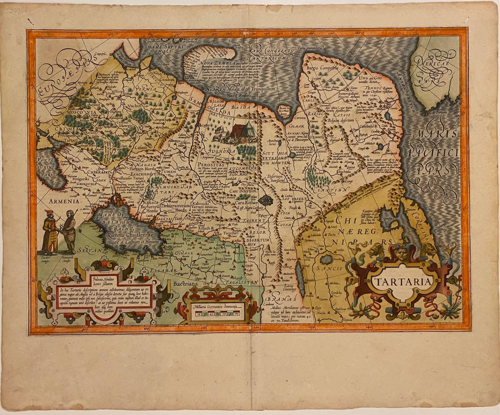
Beautiful and rare map of Tartary, extending from the Black Sea to the Pacific, and from Central Asia to the Arctic. Some notable features on this map include the Great Wall of China, Korea depicted as an island, and an early inclusion of present-day Alaska in the upper right corner with Cape Fortuna and the Straits of Anian labeled. Cities, rivers, and topographical features are labeled. Mountains and forests are depicted pictorially. Illustrations on the map depict Tatar and Samoyed figures, as well as a nomadic structure and domestic animals. This map is in very good condition, with overall wear to margins and along the original centerfold. Archival repair to centerfold at lower margin. French text on verso.
Jodocus Hondius (1563-1612) was the founder of a prolific map publishing business, which helped to propel the Dutch dominate 17th c. cartography. When Jodocus the elder died in 1612, his wife Colette ran the business until their sons came of age to join the firm. During this time, their daughter Elisabeth married Johannes Jansson and the two of them helped Colette run the business. Jodocus & Colette's youngest son, Henricus Hondius (1597-1651) later ran the business along with his extended family.
Binding: Unbound
Language: English
Price: $850.00
Item #309085