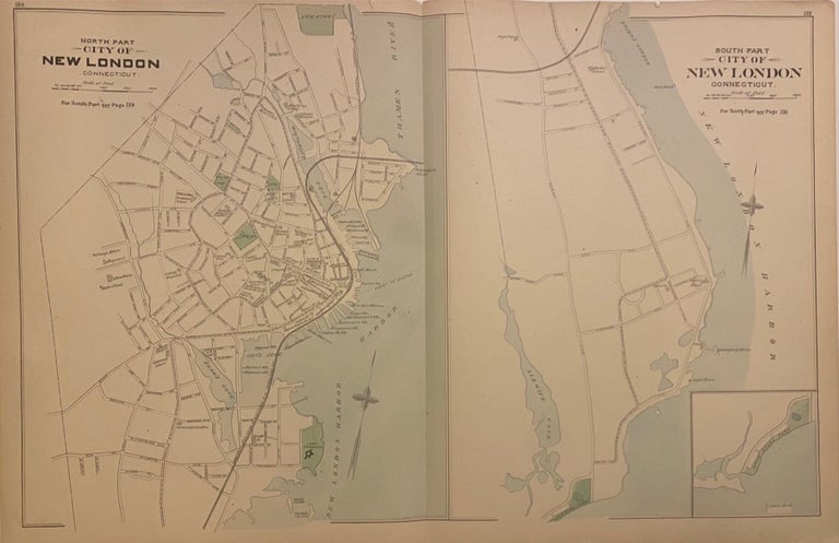
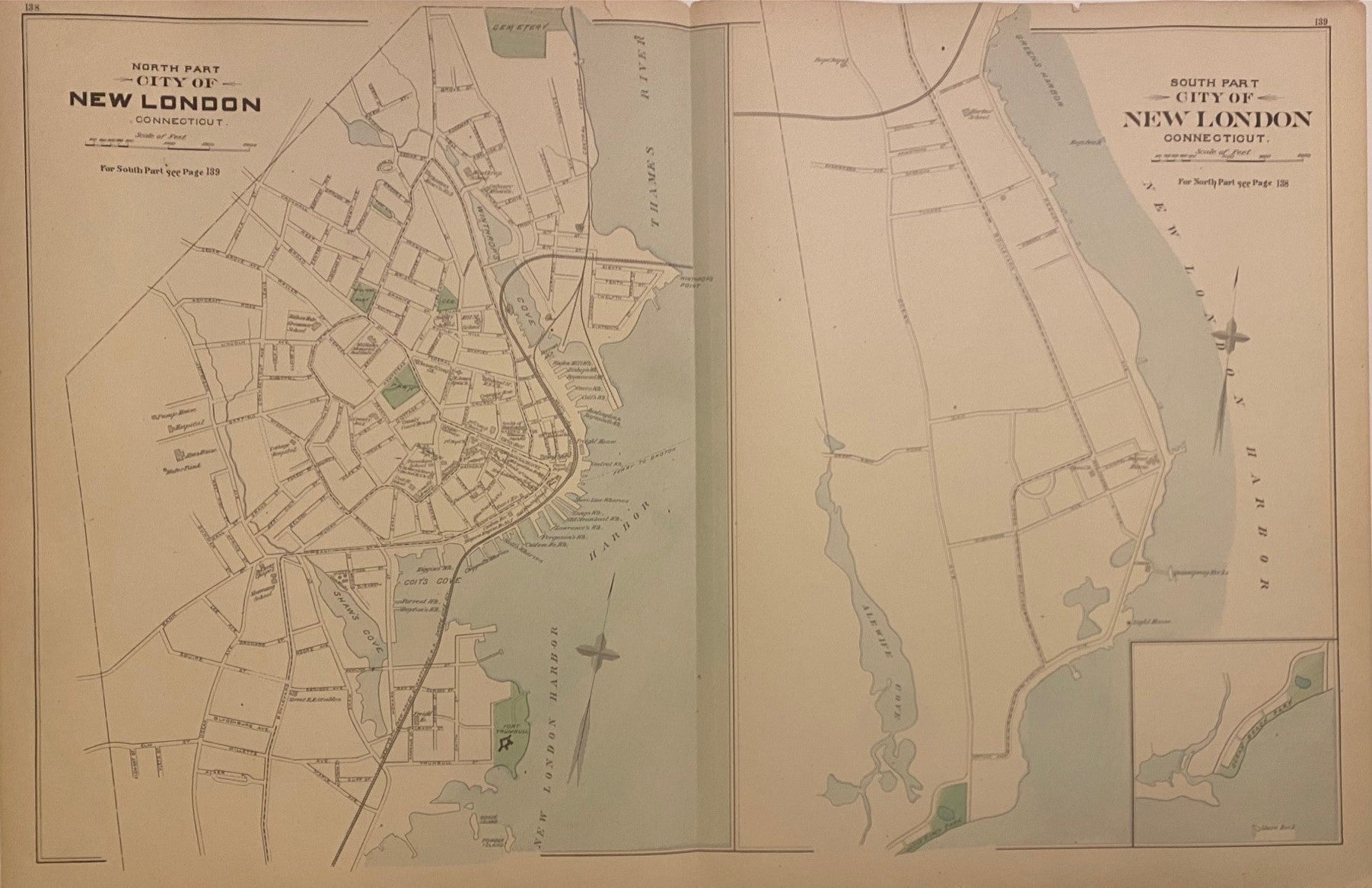
City of New London, Connecticut.
Boston: D.H. Hurd & Co., 1893.
Map. Lithograph with hand coloring. Image measures 18 x 28".
This double-page map of New London, Connecticut shows the north and south parts of the city on two sheets. The north part extends from a cemetery near present-day Riverside Park, to Fort Trumbull. The south part extends from Green's Harbor to Ocean Beach Park, with an additional inset of Ocean Beach Park. Significant roads, railroads, topographical features, buildings, and landmarks are all labeled.
The map appeared as plates 138 and 139 in D.H. Hurd and Co.'s "Town and city atlas of the state of Connecticut." Maps of other towns in New London County on verso. The map is a clear impression on bright paper. Overall wear to margins and center seam.
D.H. Hurd & Co. published only two atlases: one of New Hampshire and one of Connecticut. Yet their volumes are distinctive for their attention to detail, with each state divided into small regions that display a wealth of information related to property, topography, and infrastructure. This map exemplifies the publishing firm's scarce work.
Language: English
Price: $125.00
Item #308834