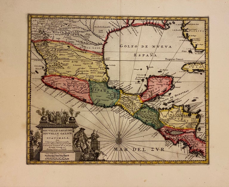
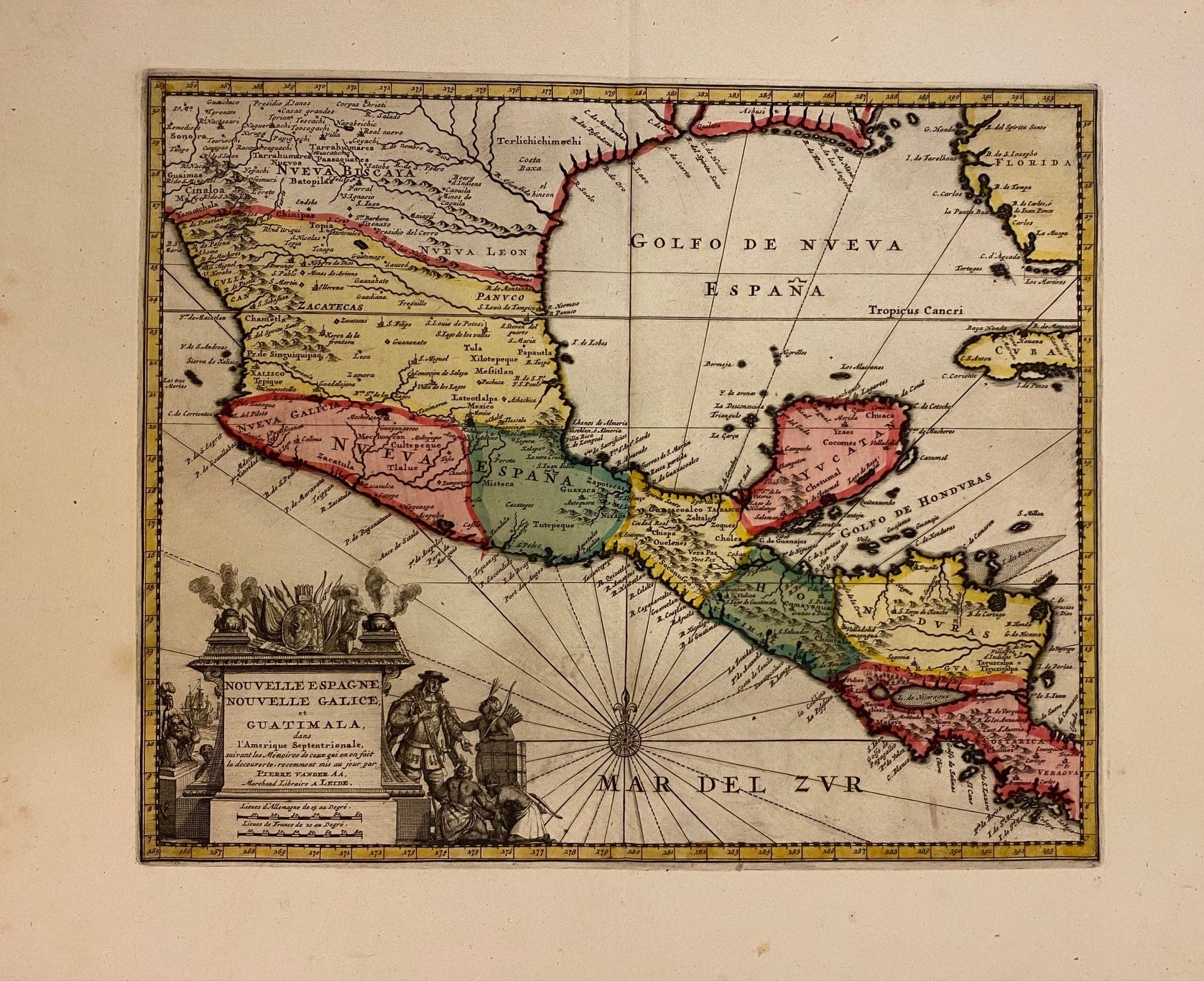
Nouvelle Espagne, Nouvelle Galice, et Guatimala
Leiden: Van der Aa, Pierre, 1729.
Map. Engraving with full hand coloring. Image measures 11 1/2" x 14". Leiden: 1729.
Finely engraved map of Mexico and Central America. Beautifully detailed, the map labels regions, towns, rivers, lakes, and coastal features. Mountains are depicted pictorially. Includes parts of Florida and Cuba. Features an elaborate title cartouche in the lower left corner. In excellent condition with full margins and lavish original color wash.
Pieter van der Aa (1659-1733) was a Dutch publisher, editor and bookseller based in Leiden, Netherlands. He started his own publishing and auction house at the age of 21 and went on to produce thousands of maps. Van der Aa is credited to pioneering a separate artwork for the border. Apart from his own maps, he republished maps of various other publishers such as Blaeu, Visscher, De Wit, etc. This map is beautiful example of his distinctive style. Hard to find.
Binding: Unbound
Price: $600.00
Item #308770