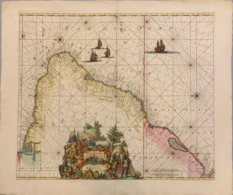
Littora Brasiliae
Amsterdam: Reiner adn Joshua Ottens.
Map. Engraving with original coloring. Image 18 3/4 x 22 inches. Amsterdam: 1740. In good condition.
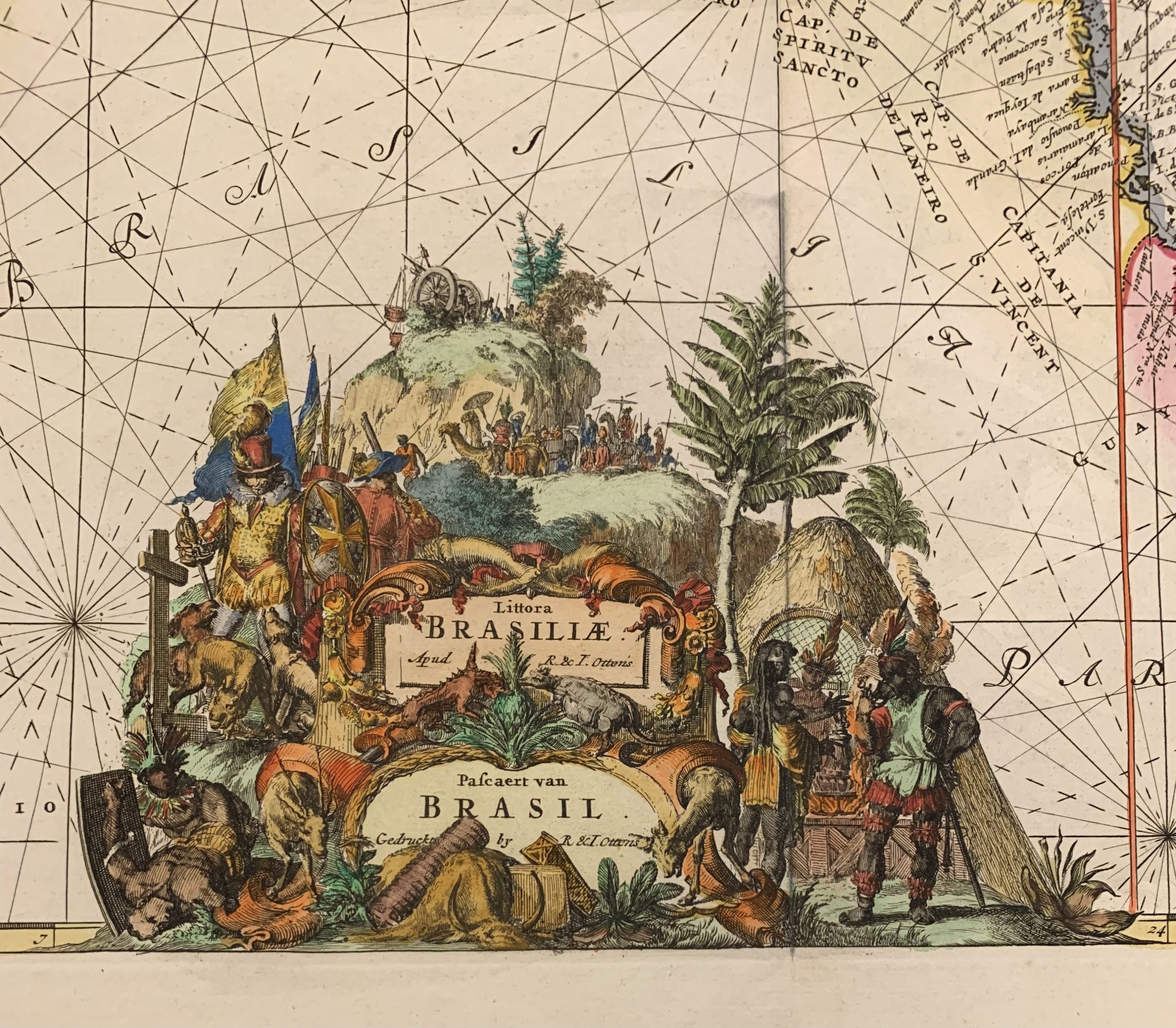
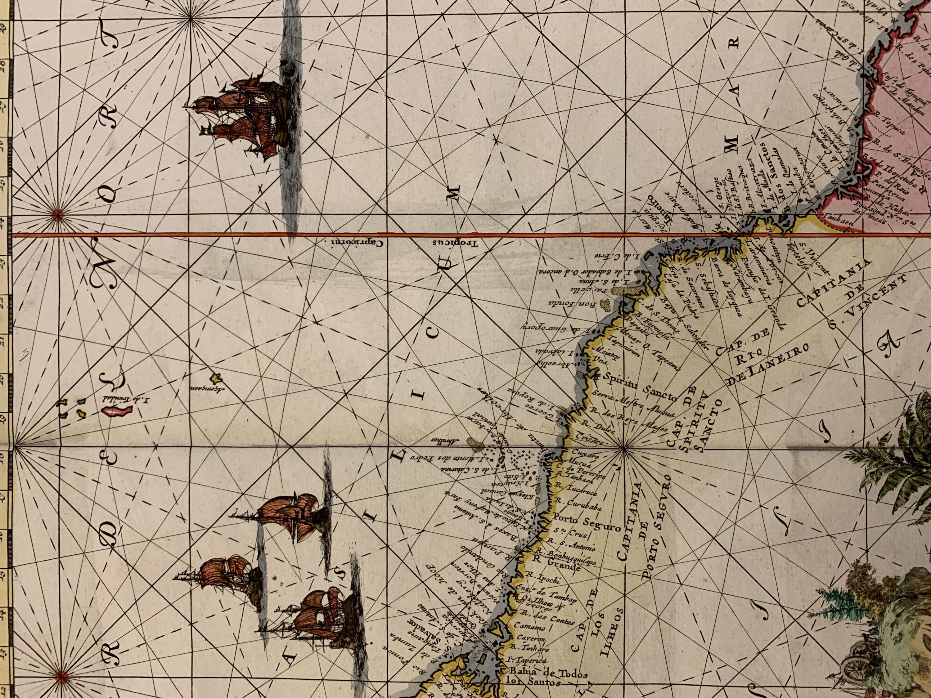
Dynamic Dutch sea chart of Brazil with north oriented toward the left. It first appeared in De Wit's 1675 sea atlas and maps the mouth of the Amazon down to Rio de la Plata, in Argentina. Giant processional cartouche by Romeyn de Hooghe describes European encounters with the New World and is placed in SE Brazil. A Spanish conquistador or possibly Dutch or Portuguese missionaries with dogs approaches the foreground which is shown with animals and commodities. Beautifully dressed Indigenous people gather in the foreground in front of architecture. The mining scene in the background alludes to the Brazilian gold rush. Reiner and Joshua Ottens (1698-1750 and 1704-1765) took over their father's map-making business in 1725. They were known best for producing enormous made-to-order map collections, including copies of almost all maps available at the time. Know for his inventive crowd scenes, Romeyn de Hooghe (1645 -1708) was an important Dutch Baroque, painter, sculptor, engraver and caricaturist. A beautiful example of this fine map.
Language: Latin
Price: $1,750.00
Item #308599