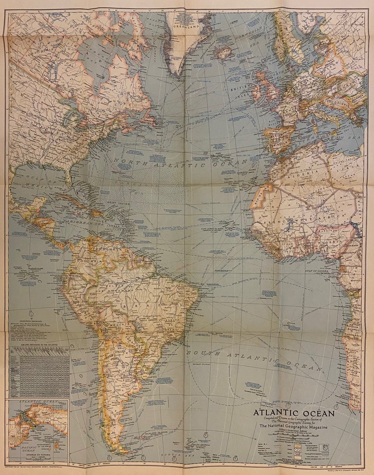
Atlantic Ocean
Washington, D.C. National Geographic Society, 1941.
Map. Full-color lithograph. Sheet measures 29 1/2" x 23 1/4"
Beautiful map of the Atlantic Ocean. It features an stereographic (Azimuthal-conformal) projection, executed by James M. Darley, Chief Cartographer, with oceanography by Apphia E. Holdstock and relief by John J. Brehm. International boundaries are depicted as of September 1, 1939. This map is in very good condition, with minor wear to edges and toning along original fold lines.
Illustrator: James M. Darley
Binding: Unbound
Language: English
Price: $65.00
Item #308569
See all items by NATIONAL GEOGRAPHIC SOCIETY