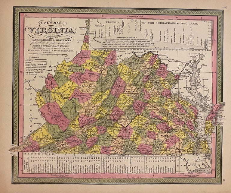
A New Map of Virginia with its Canals, Roads, & Distances
Philadelphia: Mitchell, Samuel Augustus Jr., 1864.
Map. Engraving with original hand coloring. Image measures 11 1/2" x 14 1/4"
Nicely detailed map of Virginia and West Virginia divided into counties. Shows towns, waterways, major routes, railroads and topographical details. An inset at the top depicts a profile view of the Chesapeake and Ohio Canal. A table at the bottom provides information on steamboat routes.
Samuel Augustus Mitchell Sr. (1792-1868) was one of the leaders in American cartography of the 19th century and pioneered the conversion of engraved map plates to more affordable lithographic plates. His son, Samuel Augustus Mitchell Jr. continued his father's successful mapmaking and publishing business, and was one of the most prolific and renowned 19th century American publishers.
Binding: Unbound
Language: English
Price: $250.00
Item #307829