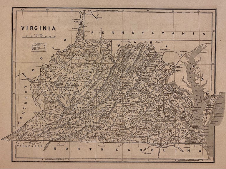
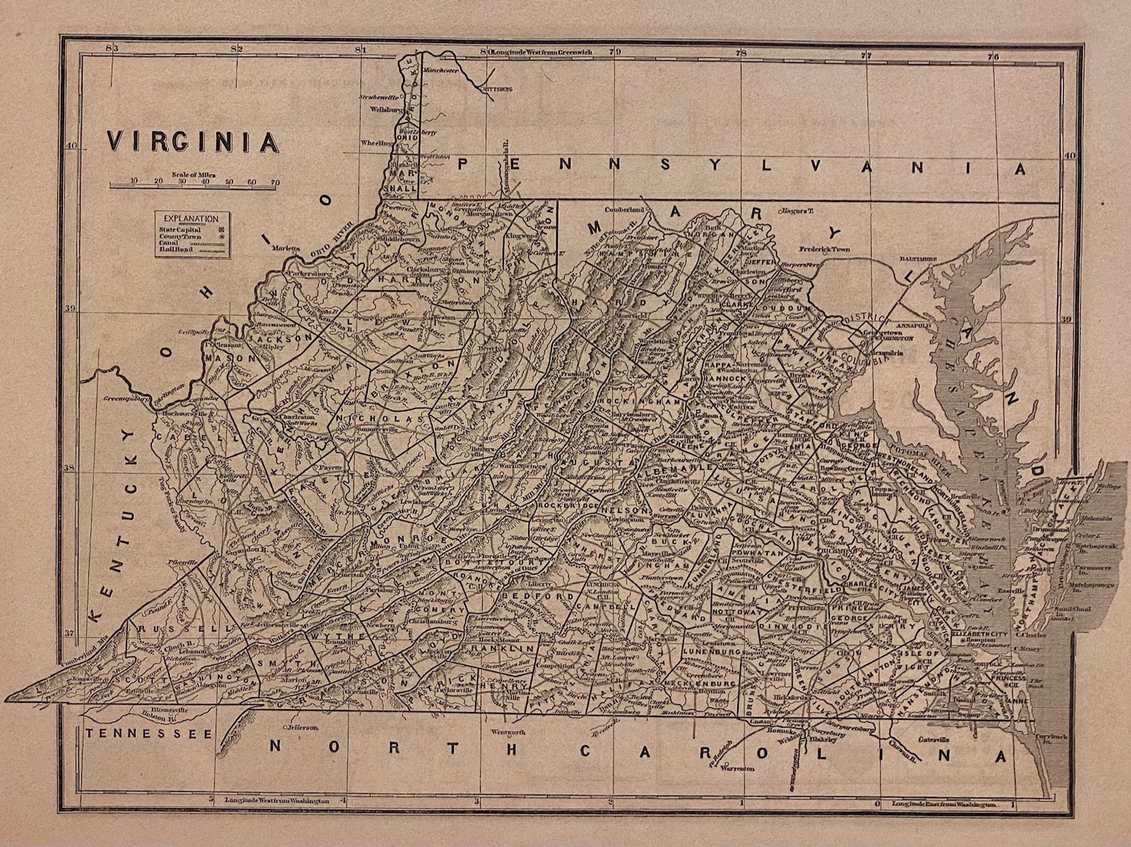
Virginia
New York: Harper & Brothers, 1842.
Map. Wax engraving (cerograph) with hand coloring. Page measures 12 3/8" x 16 1/4"
This detailed map of Virginia by Sidney Morse and Samuel Breese depicts the states divided into counties and townships. The map notes towns, roads, rivers, lakes, railroads, mountains, and other topography. Map of Maryland and Delaware on verso, with an inset of District of Columbia, and an elevation view of the Chesapeake and Ohio Canal, and the Baltimore and Ohio Railroad.
This map was featured in Morse's North American Atlas, which, when originally published in 1842, was the first atlas of the United States to feature the technique of cerography, or wax engraving, which Morse pioneered. It is from the 1845 edition of the Atlas, which was a reissue with some minor changes and the introduction of color. The map is in good condition, with several stains though out and some edge wear, including some chipping along the margins, not affecting the image. Minor toning.
Sidney Edwards Morse (1794-1871) was an American geographer, journalist, and inventor. He shared his innovative spirit with his brother, Samuel F.B. Morse, and his father Jedidiah Morse, who published the first geography book in the United States in 1784. Morse pioneered the printing process of wax engraving, otherwise known as cerography. Some foxing and toning but otherwise in good condition. This map is a fine example of Morse's innovative cerographic technique.
Binding: Unbound
Language: English
Price: $175.00
Item #307759