
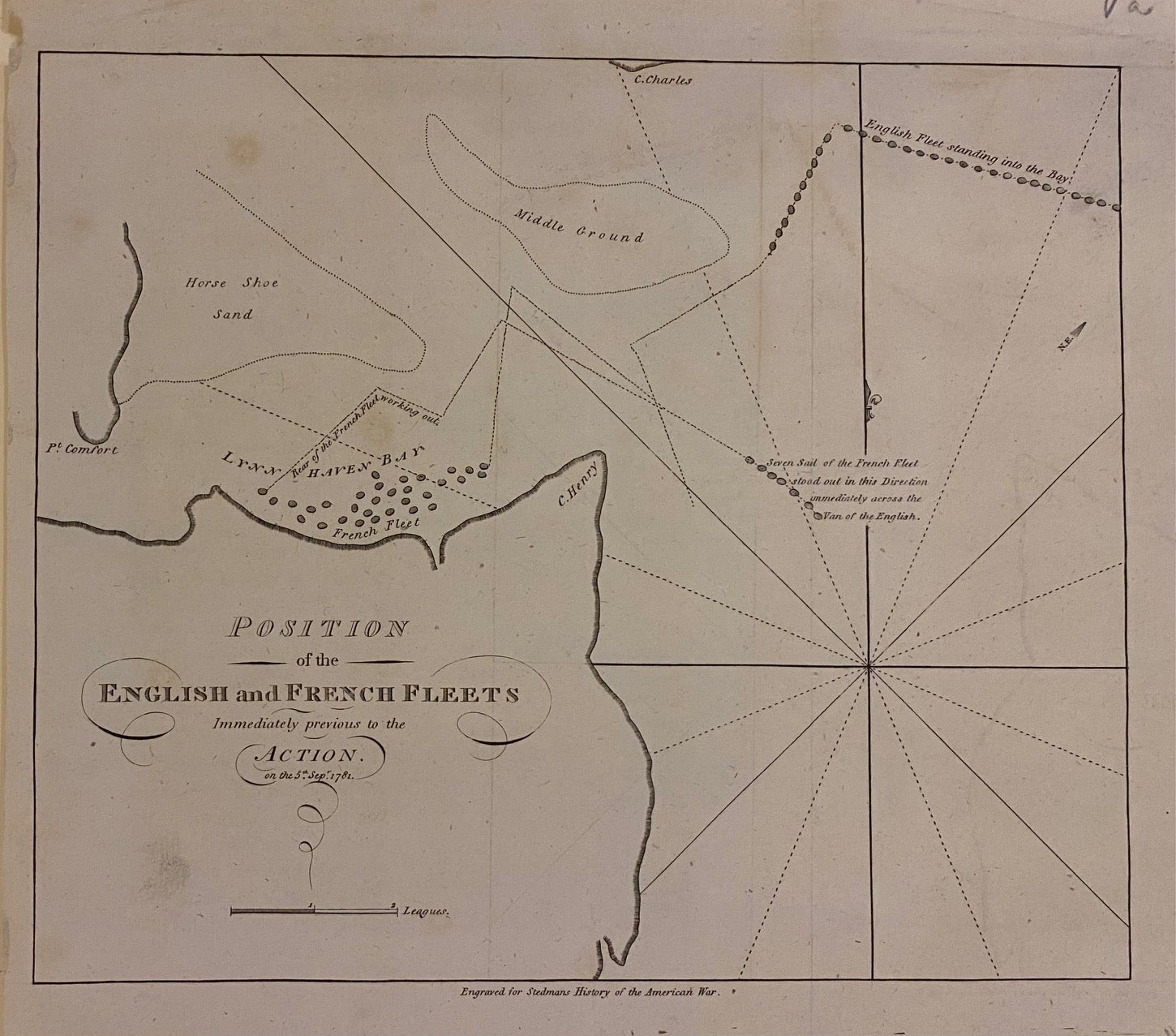
Position of the English and French Fleets Immediately previous to the Action
London: 1793.
Map. Uncolored engraving. Image measures 10.75" x 12.75".
This map showing the positions of the English and French fleets before the battle at Yorktown is an important contemporary representation of a pivotal moment in the American Revolution. This second issue of the map, originally published in Banastre Tarleton's "A History of the Campaigns of 1780 & 1781", was engraved for Stedman's 1793 "History of the American War." The battle involved a surprise attack by the French and the Americans on Cornwallis's troops stationed in the Lower Chesapeake. The map shows the fleets at the entrance of the Chesapeake Bay, between Cape Henry and Cape Charles. The map is in very good condition with a narrow left margin. Some minor offsetting.
Philadelphia-born military historian Charles Stedman was a Loyalist who served under General Cornwallis. After escaping American capture, he published his authoritative two-volume history of the war, which is seen today as the best contemporary account of the Revolution from the British side. This map is a fine example of his work.
Language: English
Price: $350.00
Item #307742