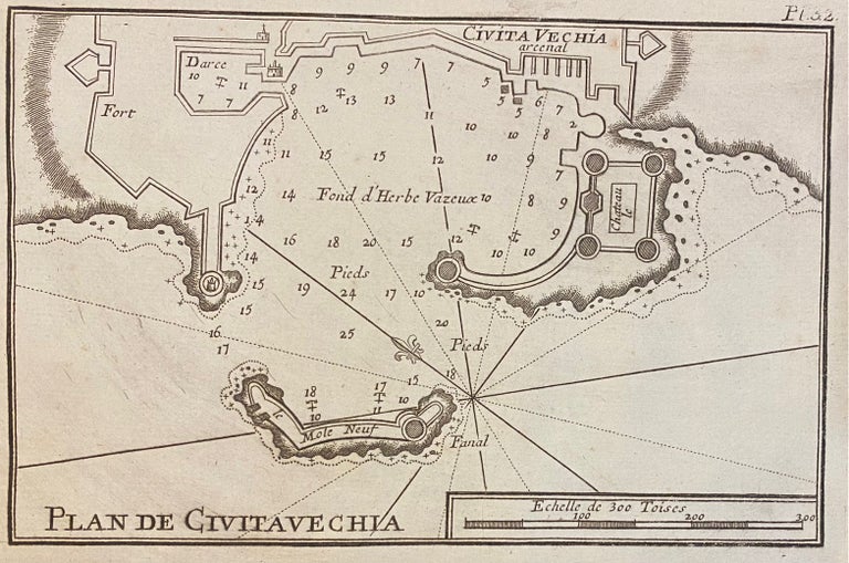
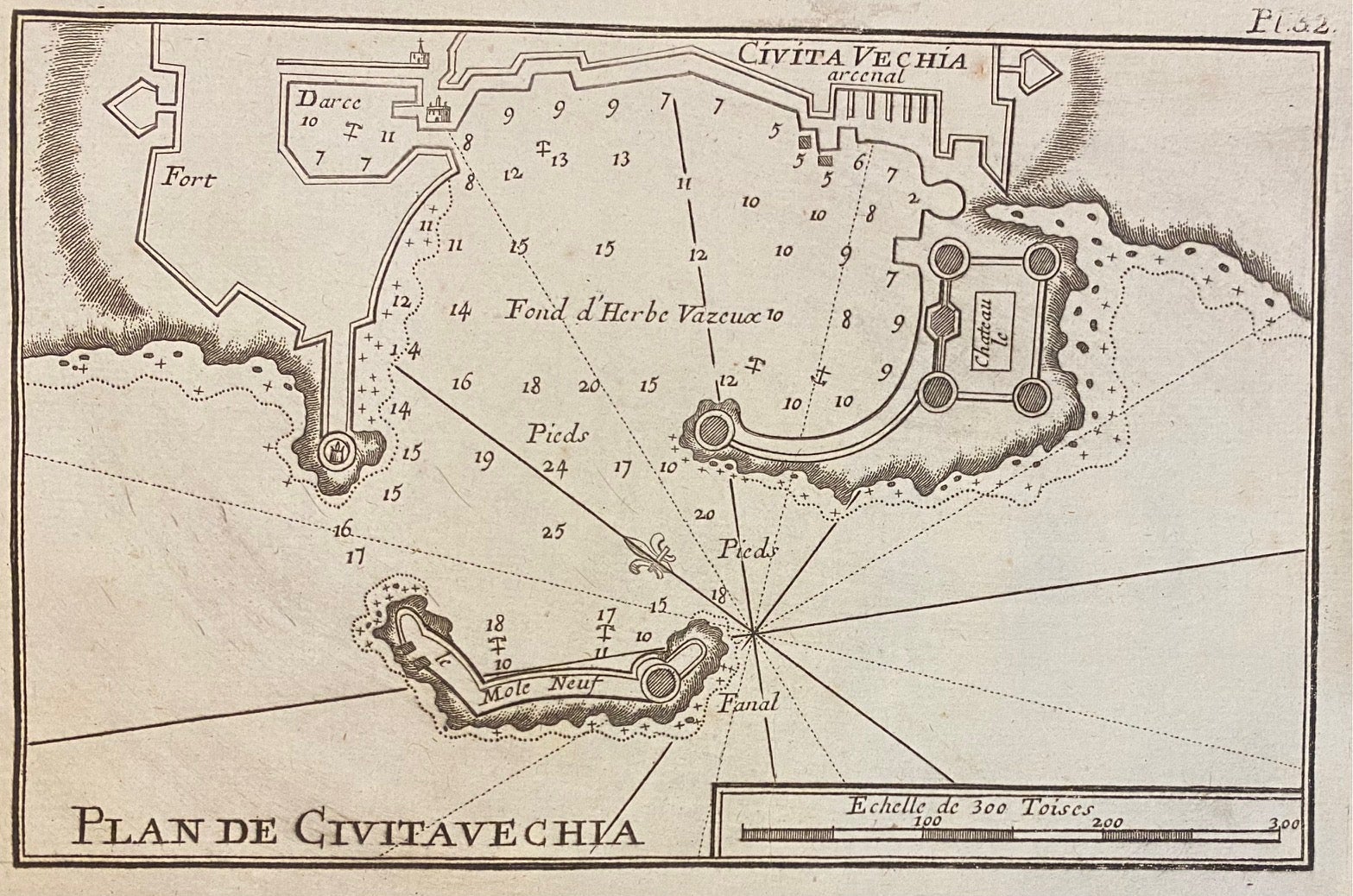
Plan de Civitavechia
Marseille: Joseph Roux.
Map. Uncolored engraving. Measures 5" x 7 3/4". In very good condition.
Lovely miniature nautical chart depicting the port of Civitavecchia in Italy, also known as the Port of Rome. The chart depicts the harbor, which was built in the early 2nd century, as well as surrounding fortifications and structures -- including the now destroyed naval arsenal, designed by Bernini in 1663.
Plate 32 from Roux's "Receuil Des Principaux Plans des Ports, et Rades de la Mer Mediterranee" (1764).
Binding: Unbound
Language: English
Price: $150.00
Item #307651
See all items by Joseph ROUX