
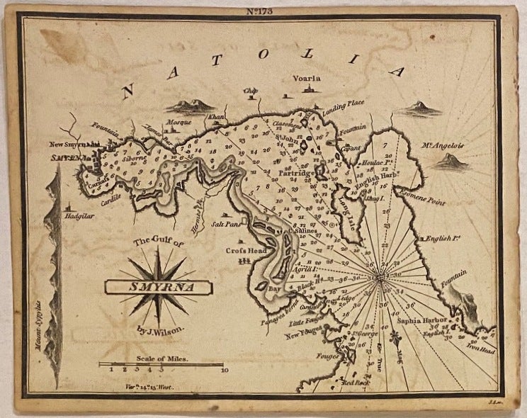
The Gulf of Smyrna
London: William Heather, 1824.
Map. Uncolored engraving. Measures 6 1/4" x 7 1/2"
Extensively labeled nautical chart depicting Gulf of Smyrna, including an elevation view showing the ancient Mount Sipylus. Map was drawn by Norie after J. Wilson, and engraved by J. Stephenson. Published in "The New Mediterranean Harbour Pilot", a maritime atlas containing 228 navigational charts, showing sandbanks, anchorages, harbors, major cities, ports, towns, buildings, roads, bays, buoys, forts, landmarks, shorelines, lighthouses, coastal profiles, mountains and islands. Depths shown by isolines, soundings, and rhumb lines. This map is in good condition, with minor toning and offsetting throughout.
Illustrator: James Wilson
Language: English
Price: $200.00
Item #307567