
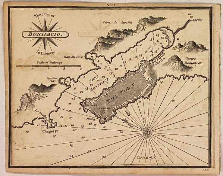
The Port of Bonifacio
London: William Heather, 1824.
Map. Uncolored engraving. Measures 6 1/4" x 7 1/2"
Beautifully rendered nautical chart depicting the of port of Bonifacio in southern Corsica. The town is built on the site of a citadel built in the 9th century. Mountains are depicted pictorially. Map was drawn by Norie and engraved by J. Stephenson. Published in "The New Mediterranean Harbour Pilot", a maritime atlas containing 228 navigational charts, showing sandbanks, anchorages, harbors, major cities, ports, towns, buildings, roads, bays, buoys, forts, landmarks, shorelines, lighthouses, coastal profiles, mountains and islands. Depths shown by isolines, soundings, and rhumb lines.
Language: English
Price: $200.00
Item #307565