
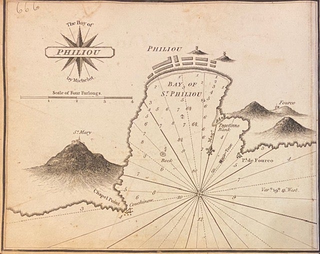
The Bay of Philiou
London: William Heather, 1824.
Map. Uncolored engraving. Measures 6 1/4" x 7 1/2"
Beautifully rendered nautical chart depicting the bay of Sant Feliu de Guixols, in Catalonia on the Mediterranean coast. Map was drawn by Norie after Henri Michelot. Published in "The New Mediterranean Harbour Pilot", a maritime atlas containing 228 navigational charts, showing sandbacks, anchorages, harbors, major cities, ports, towns, buildings, roads, bays, buoys, forts, landmarks, shorelines, lighthouses, coastal profiles, mountains and islands. Depths shown by isolines, soundings, and rhumb lines.
Illustrator: Henri Michelot
Language: English
Price: $150.00
Item #307559
See all items in
MEDITERRANEAN,
SPAIN
See all items by J. W. NORIE