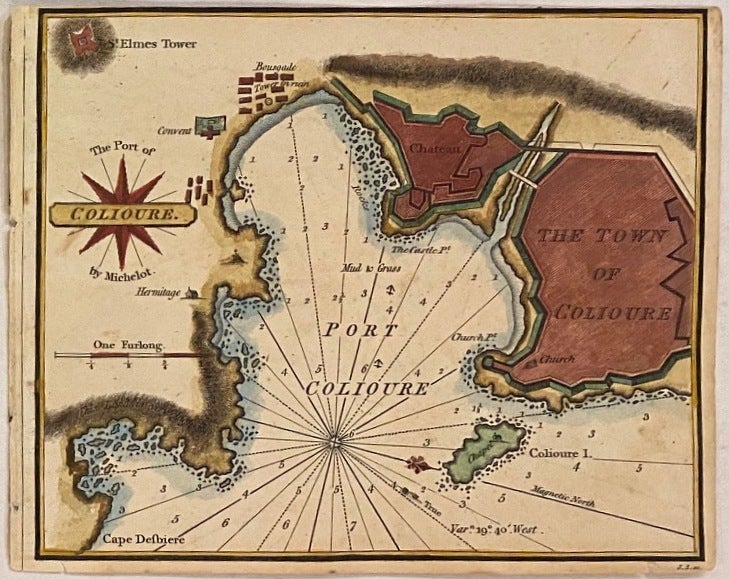
The Port of Colioure
London: William Heather, 1824.
Map. Engraving with hand coloring. Measures 6 1/4" x 7 1/2"
Beautifully rendered nautical chart depicting the French town of Collioure on the Mediterranean coast, after Henri Michelot. Features the fortified town, the Chateau Royal de Collioure, Fort St. Elme, and the bell tower.
Published in "The New Mediterranean Harbour Pilot", a maritime atlas containing 228 navigational charts, showing sandbacks, anchorages, harbors, major cities, ports, towns, buildings, roads, bays, buoys, forts, landmarks, shorelines, lighthouses, coastal profiles, mountains and islands. Depths shown by isolines, soundings, and rhumb lines. Extremely scarce to the market with few institutional copies.
Illustrator: Henri Michelot
Language: English
Price: $200.00
Item #307558