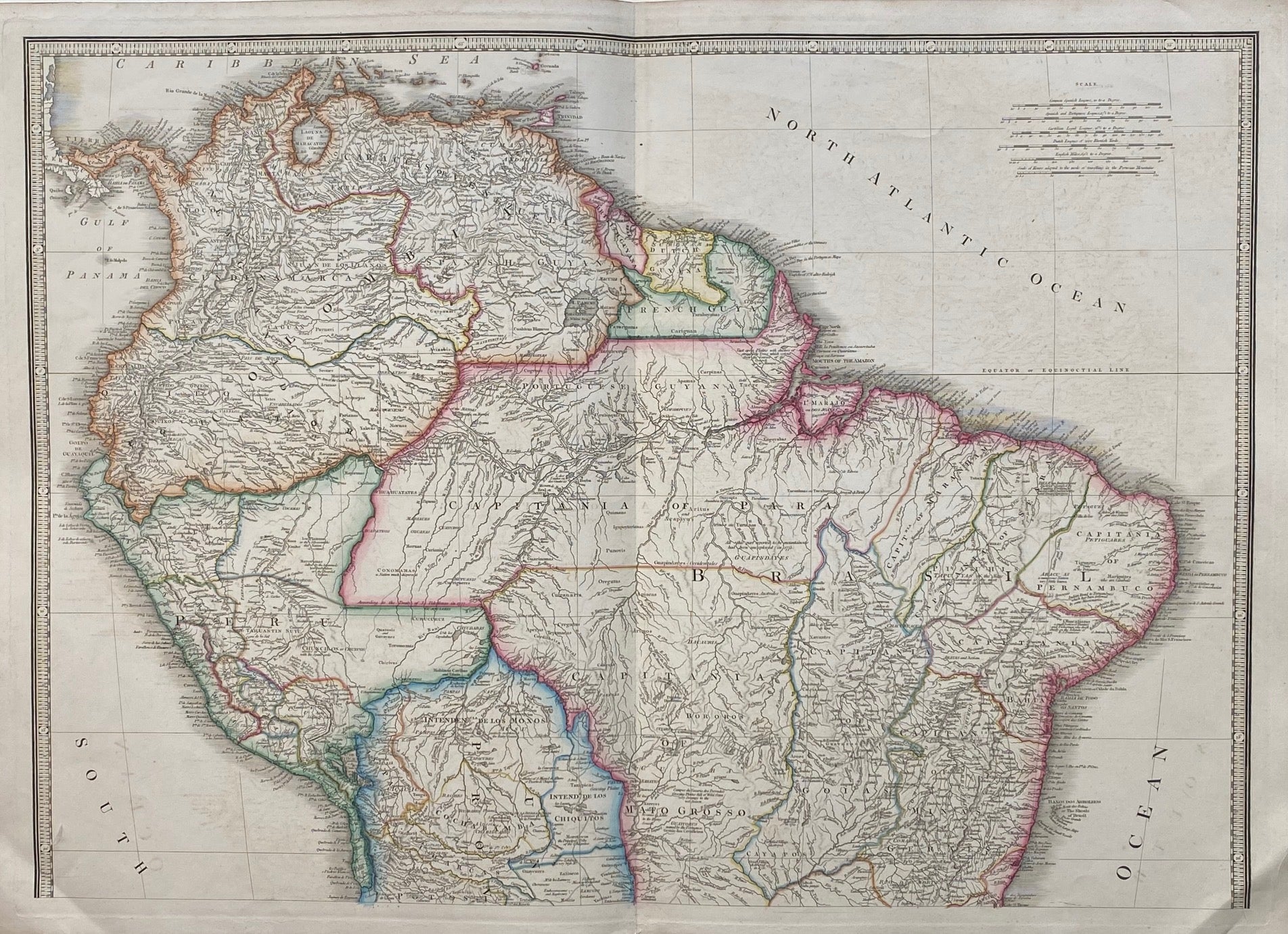
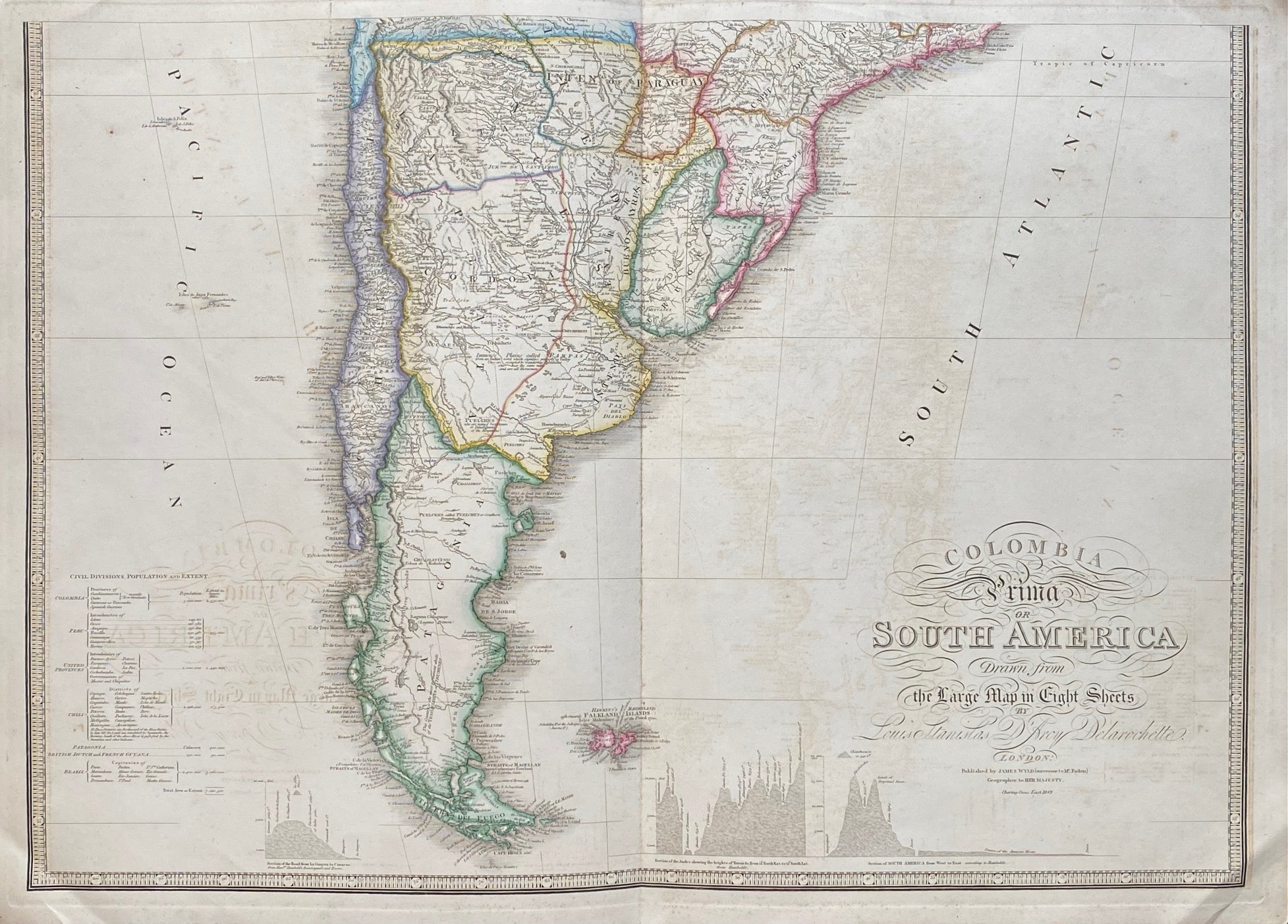
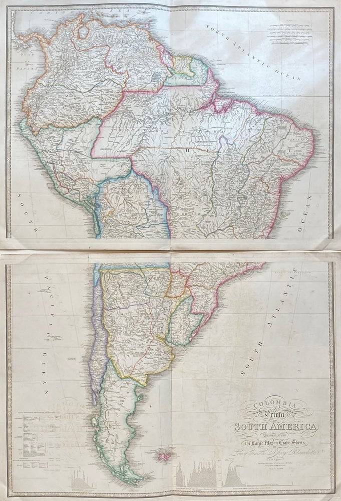
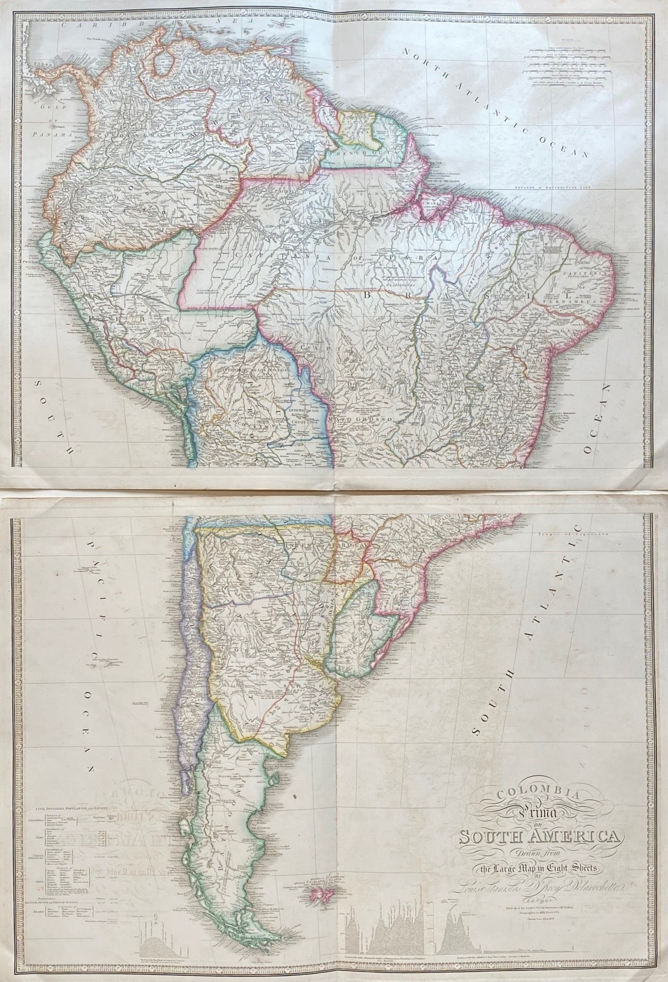
Colombia Prima or South America drawn from the Large Map in Eight Sheets
London: James Wyld, 1845.
Map in 2 sheets. Engraving with original hand coloring. Each image measures 21.25" x 30.25, each page measures 23.5" x 32.25".
This exquisitely detailed map was compiled from Louis Stanislas d'Arcy Delarochette's manuscript map of South America. Published shortly after independence movements swept the continent, liberating most the region from Spanish and Portuguese rule, the map shows few remnants of colonial holdings and is colored to represent newly established civil divisions. It also includes topographical profiles of the Andes, the Cordillera de la Costa Central, and elevation of the course of the Amazon River. The map is in excellent condition, with very minor offsetting. This map was published by James Wyld, William Faden's successor.
James Wyld Jr. (1812-1887), a distinguished British mapmaker and the official Geographer to Queen Victoria. He inherited his publishing business from his father, James Wyld Sr. (1790-1836), who was a founding member of the Royal Geographical Society, known for producing maps and globes, and introduced lithography techniques to his production. He also served as the official Geographer to George IV and William IV.
Louis Stanislas d'Arcy De la Rochette (1731 - 1802) was a British cartographer and engraver based in late 18th century London. He produced maps in conjunction with various other contemporary British cartographers, such as William Faden, James Wyld, Laurie & Whittle, Thomas Kitchin, and others. This is a lovely example of their fruitful collaboration.
Binding: Unbound
Language: English
Price: $600.00
Item #306965