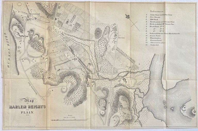
Map of Harlem Heights & Plain
New York: D. T. Valentine, 1856.
Map. Engraving. Image measures 11" x 16 1/2"
Fascinating map of Harlem in 1814, published in D. T. Valentine's Manual of 1956. Extending from the Hudson River to the fork of the Harlem and East Rivers, the map depicts the area during the War of 1812, showing fortifications erected to protect against British invasion. A key in the upper right labels these fortifications and other points of interest, including the Stone Tower on Hallet's Point, Fort Stevens, fortification on Benson's Point, works to defend McGowans Pass and the pass at Manhattanville. The area remains mostly rural, with two villages at Manhattanville and Harlem transected by Bloomingdale Rd., Harlem Lane, and Kingsbridge Road, connecting the upper part of the island with New York City and the rest of the northeast.
Language: English
Price: $265.00
Item #306626