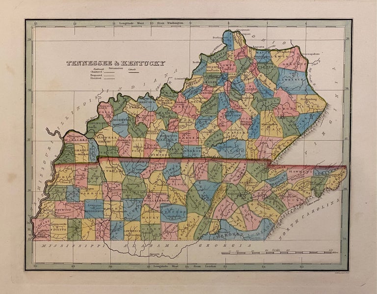
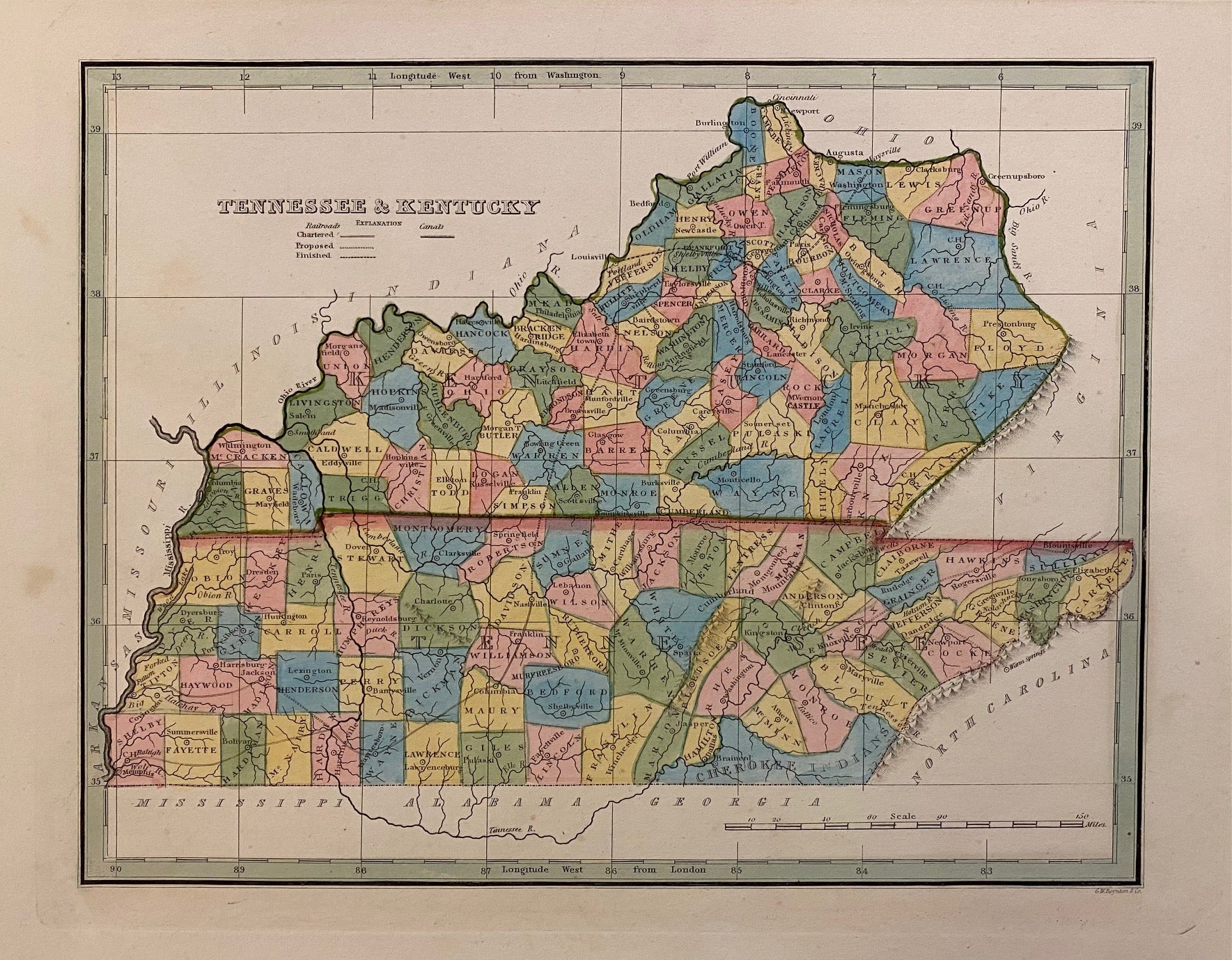
Tennessee & Kentucky
Boston: Bradford, Thomas Gamaliel, 1835.
Map. Engraving with hand-coloring. Image measures 7 7/8" x 10 1/8"
Early map of Tennessee and Kentucky divided into counties. Shows towns, waterways, railroads and topographical details. Published after the passage of the Indian Removal Act 1830, but before Cherokee Removal in 1838, this map includes Cherokee Territory (and Brainerd mission) in the southeast corner. Minor spotting at margins, not affecting the image.
T.G. Bradford (1802-1887) was a Boston based publisher. He worked as assistant editor of the American Encyclopedia before entering the field of map making.
Illustrator: Boynton, G.W.
Binding: Unbound
Language: English
Price: $100.00
Item #306026