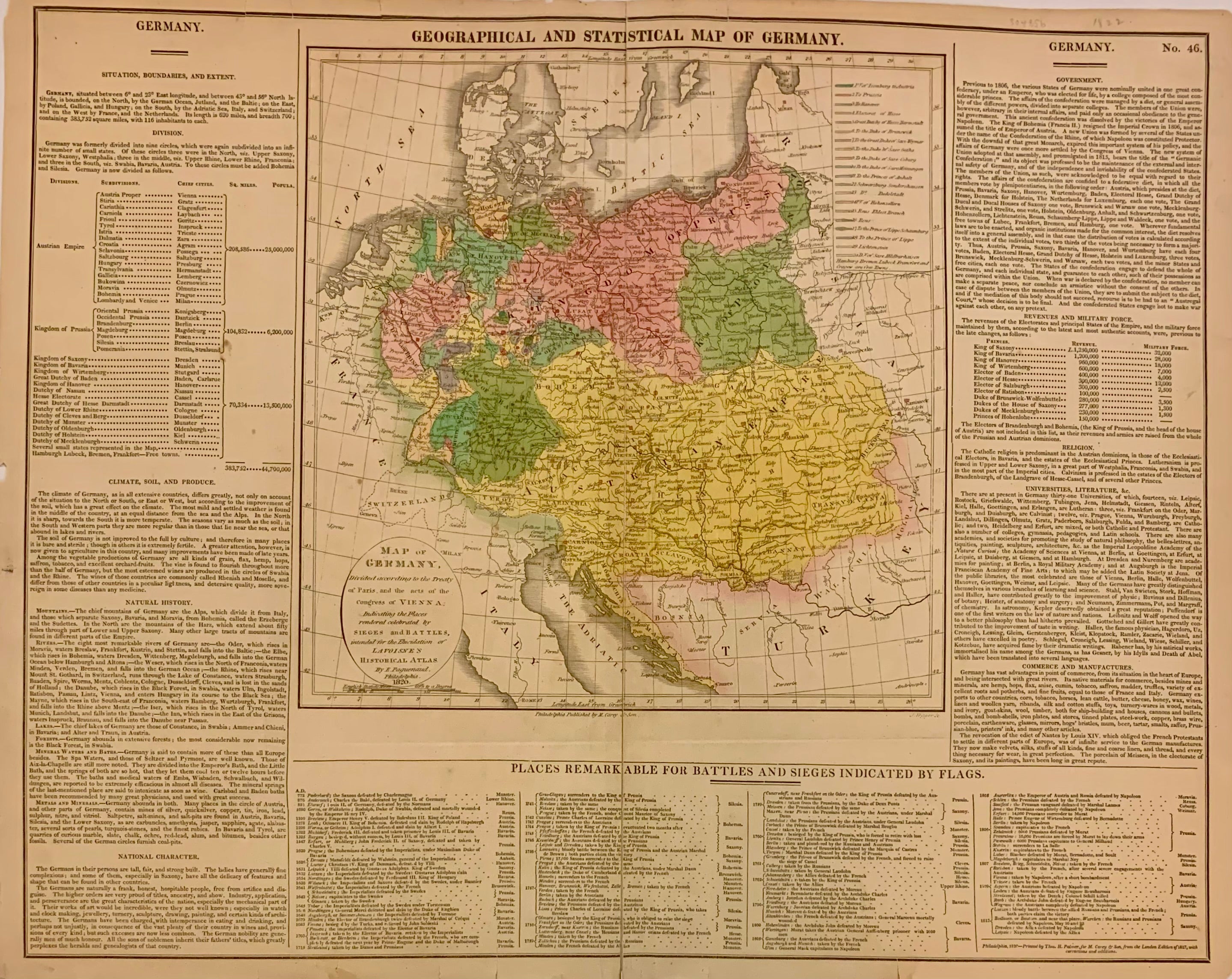
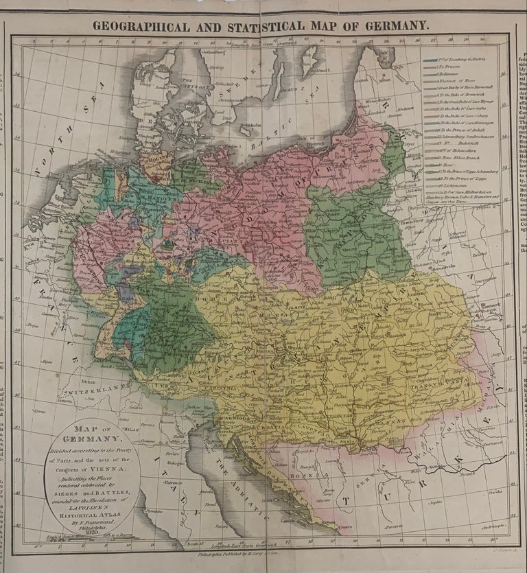
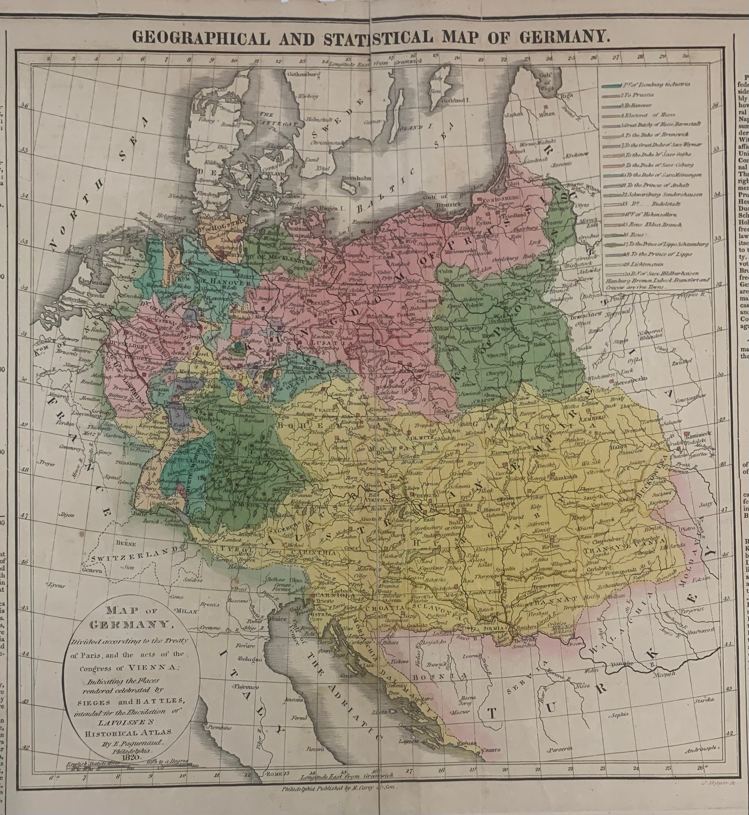
Geographical, Statistical, and Historical Map of Germany
Philadelphia: Carey & Lea, 1823.
Map. Engraving with original hand coloring. Map measures 9 3/4" x 11 3/4". Map plus text measures 17 3/4" x 22 3/8".
Detailed and informative map of Germany divided according to the Treaty of Paris showing major routes. Austria and Prussia are included. Surrounding text includes geographical information, as well as information on population, commerce, education, religion, and government. Flags note the history ow battles. From Some toning an chips to margins but otherwise in good condition. "A Complete Historical, Chronological, and Geographical American Atlas..." of 1823.
The Philadelphia-based firm of Carey & Lea of Philadelphia was one of the most important publishers in the early 19th-century United States. Run by Henry Carey (1793-1879) and Isaac Lea (1792-1886), the company worked with both books and maps, specializing particularly in political commentary. Their "Complete Historical, Chronological, and Geographical American Atlas," first published in 1822, not only contained some of the earliest maps of western states being admitted to the Union, it also provided ample information on each states providing an invaluable window into the nation's history.
Binding: Unbound
Language: English
Price: $150.00
Item #304856