
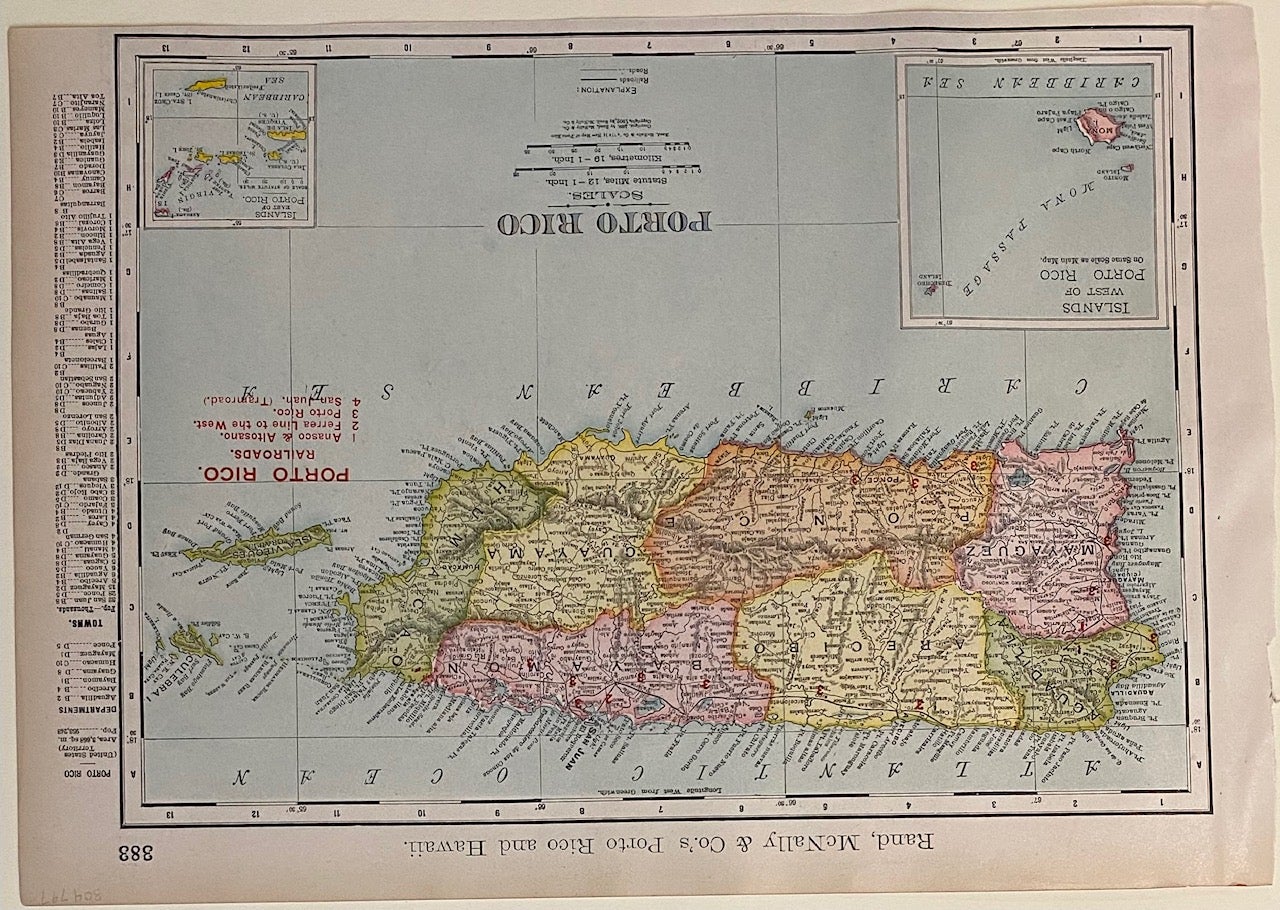
Porto Rico
Rand McNally & Co., 1898.
Map. Color lithograph. Image measures 9 1/4" x 12 1/2"
Detailed map of Puerto Rico colored by department and thoroughly labeled with cities, towns, rivers, lakes, coastal features. Topography is depicted by hachures, showing names of mountain ranges and hills, and including altitudes of prominent peaks. Railroads are labeled and numbered by corresponding operator. The map also includes insets of the islands to the west and east of Puerto Rico (Mona Island, and the Virgin Islands). Index of departments and towns with their respective populations included in right margin.
Rand McNally is an American publishing company specializing in maps, atlases and globes. Founded by William Rand in 1856, who hired Andrew McNally in 1858 to work in his shop. The two men formally established Rand McNally & Co. in 1868. The firm remains in business today.
Binding: Unbound
Language: English
Price: $50.00
Item #304797