
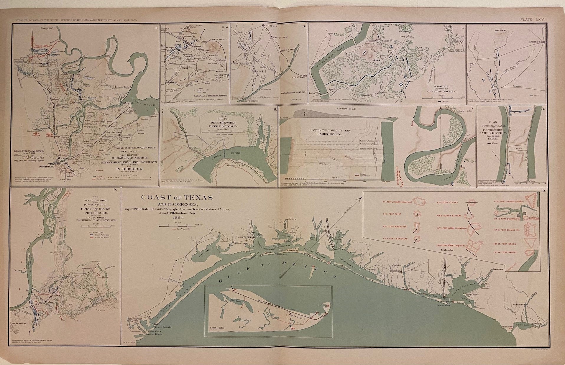
Coast of Texas and its Defenses
New York: Julius Bien & Co.; US War Department, 1864.
Map. Color lithograph. Image measures 18" x 29"
This fascinating sheet from "Atlas to Accompany the Official Records of the Union and Confederate Armies (1861-1865)" features a map of the gulf coast of Texas, extending from the Rio Grande to Sabine Lake, showing major towns, roads and rail ways. Includes an inset of Galveston, and another inset with plans of the thirteen forts and batteries visible on the map. The sheet includes nine additional maps showing various plans and sketches to accompany reports by Generals W.T. Sherman, G. Weitzel, J.M. Schofield, and Lieut. P.S. Michie. In these battle sketches, blue lines for the Union and red for the Confederacy show the geographical location of the various armies. Minor chips at margins, not affecting the image. This map is a wonderful piece that boldly documents American history.
Julius Bien (1826-1909) was an American lithographic printer and cartographer based in New York City. During the course of the second half of the 19th century, he produced thousands of maps for both public and private publishers. Some of his most notable commissions were for the U.S. government, including many geological maps that redefined the cartographic visualization of geology. Bien's prolific output and contributions to the development of chromolithography make him one of the most significant map printers of his time.
Language: English
Price: $350.00
Item #304641