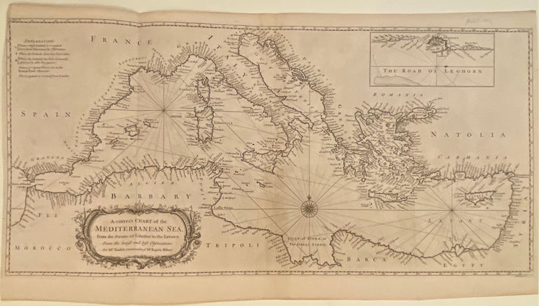
A Correct Chart of the Mediterranean Sea
1751.
Map. Engraving with hand coloring. Image 13 1/2" x 28 1/4"
Striking sea chart of the Mediterranean Sea with coastlines extensively labeled. Extends from the straits of Gibraltar to the Levant. Inset for the Road of Leghorn in the upper right corner, depicting the city of Livorno and surroundings. This map is in excellent condition, with no chips or tears. Minor toning to original centerfold, crease to upper left corner, and minimal scattered foxing.
Richard William Seale (1732--1775) was a British engraver and cartographer in the Rococo tradition. While known best for his maps of England, he also contributed to many books, atlases, and magazines. Published in the English edition of Rapin's "History of England" (1724-27), translated from the French by Tindal.
Language: English
Price: $750.00
Item #304338