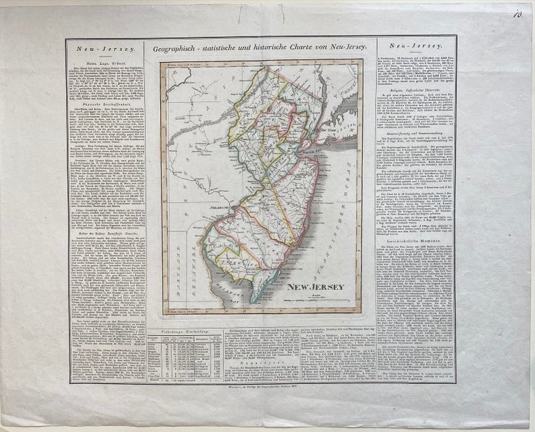
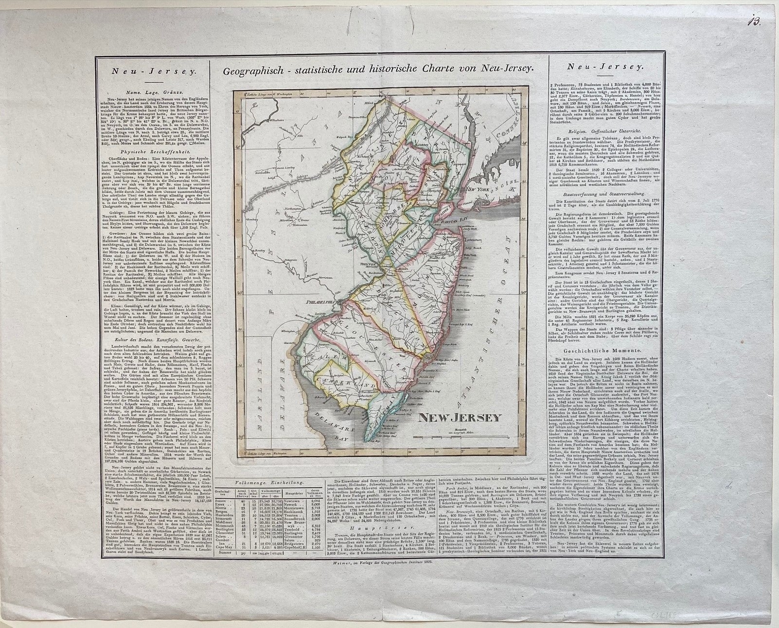
Geograpisch-statistische und historische Charte von Neu-Jersey
Weimar: Geographischen Instituts, 1825.
Map. Engraving with original hand coloring. Image measures 11 3/4" x 9 1/4", sheet measures 19 1/4" x 24 1/2"
Finely engraved double-page map of New Jersey. Shows counties, towns, waterways, topographical features, and roads. Includes historical and cultural information in German. This map appeared in the rare German edition of Carey and Lea's 1822 "A Complete Historical, Chronological, and Geographical American Atlas", published by the Weimar Geographischen Instituts. In very good condition. Minor wear to margin and centerfold, and two closed tears at upper margin, not affecting the image. Hard to find.
Illustrator: J. Carez
Binding: Unbound
Language: English
Price: $400.00
Item #303780