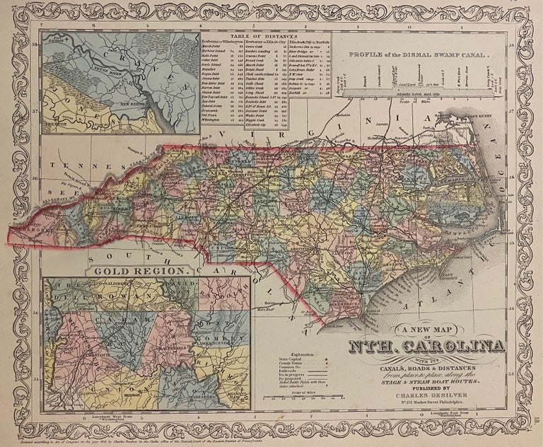
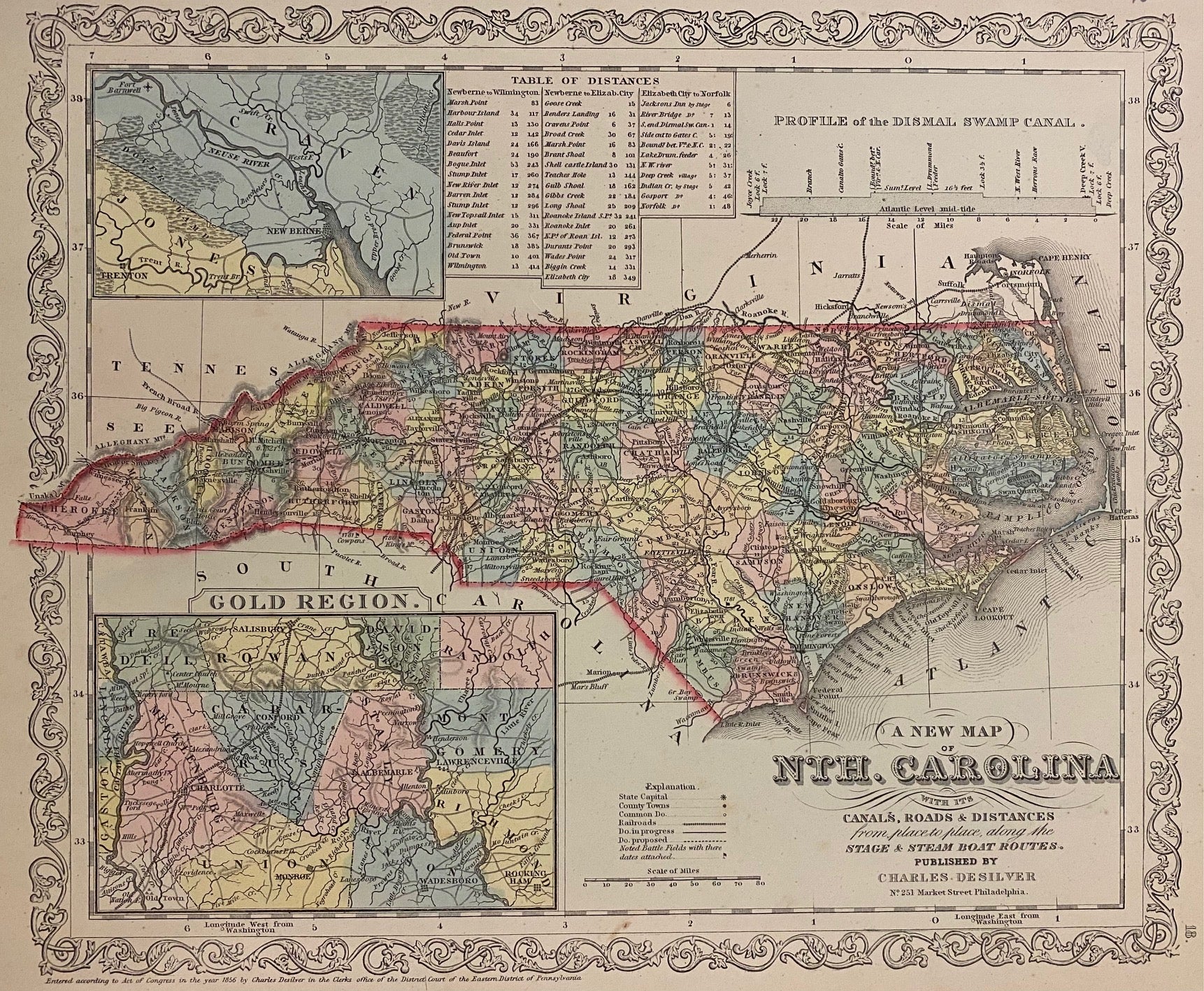
A New Map of the Nth. Carolina with its Canals, Roads & Distances from place to place, along the Stage and Steam Boat Routes.
Philadelphia: Desilver, Charles, 1857.
Map. Engraving with original hand coloring. Image measures 11 3/4" x 14"
Nice clear map of North Carolina divided into counties. Shows towns, major routes, battle sites, railroads and waterways. Insets include the Gold Region and New Berne. Features a table of distances and the profile of the "Dismal Swamp Canal". From the "New Universal Atlas". Plate was originally published by Samuel Augustus Mitchell, who sold the copyright to Thomas, Cowperthwait & Company in 1850, which was in turn bought by Charles Desilver in 1856. Some scattered foxing. Full original margins.
Binding: Unbound
Language: English
Price: $200.00
Item #303644
See all items by Charles DESILVER