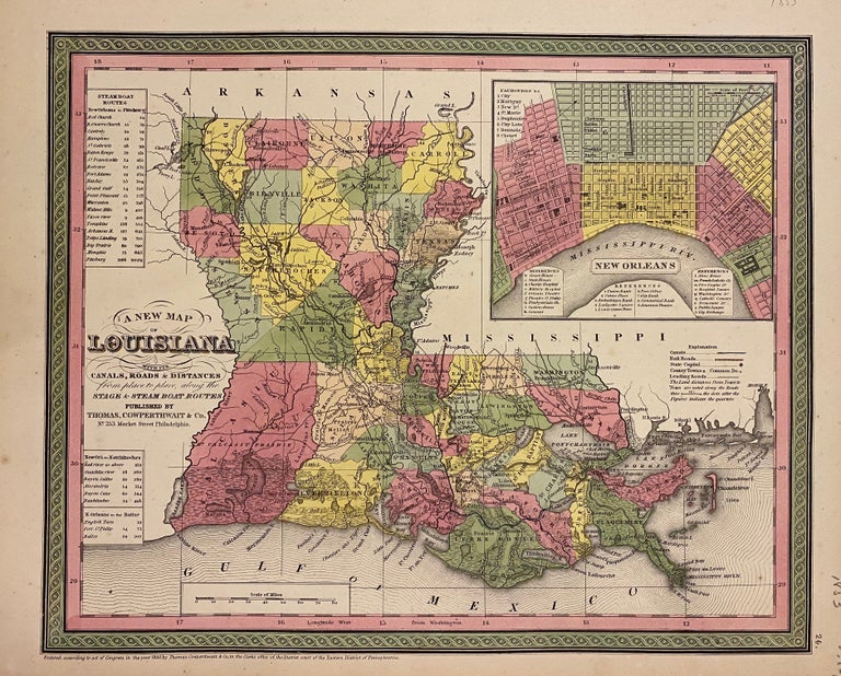
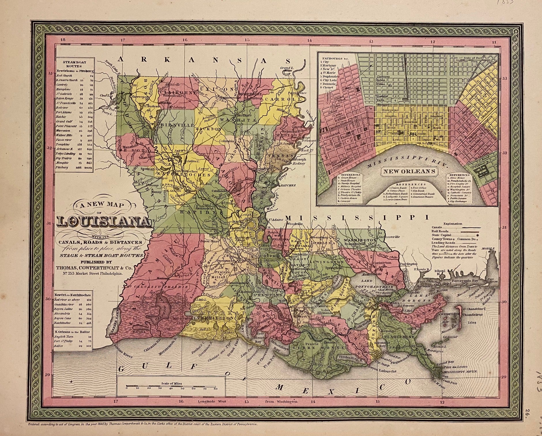
A New Map of Louisiana with its Canals, Roads & Distances from place to place, along the Stage & Steam Boat Routes
Thomas, Cowperthwait & Co., 1853.
Map. Engraving with original hand coloring. Image measures 11.5" x 14.5".
Beautiful map of Louisiana divided into counties. Shows towns, major routes and waterways. Includes inset town plan of New Orleans and information about steam boat routes. Minor overall toning and light scattered foxing. Thomas, Cowperthwait & Co. took over publication of S. A. Mitchell's important "Universal Atlas" in 1850, and continued to produce updated maps that were considered some of the best commercial cartography of the 19th century.
Binding: Unbound
Language: English
Price: $175.00
Item #302572
See all items by COWPERTHWAIT THOMAS, CO