
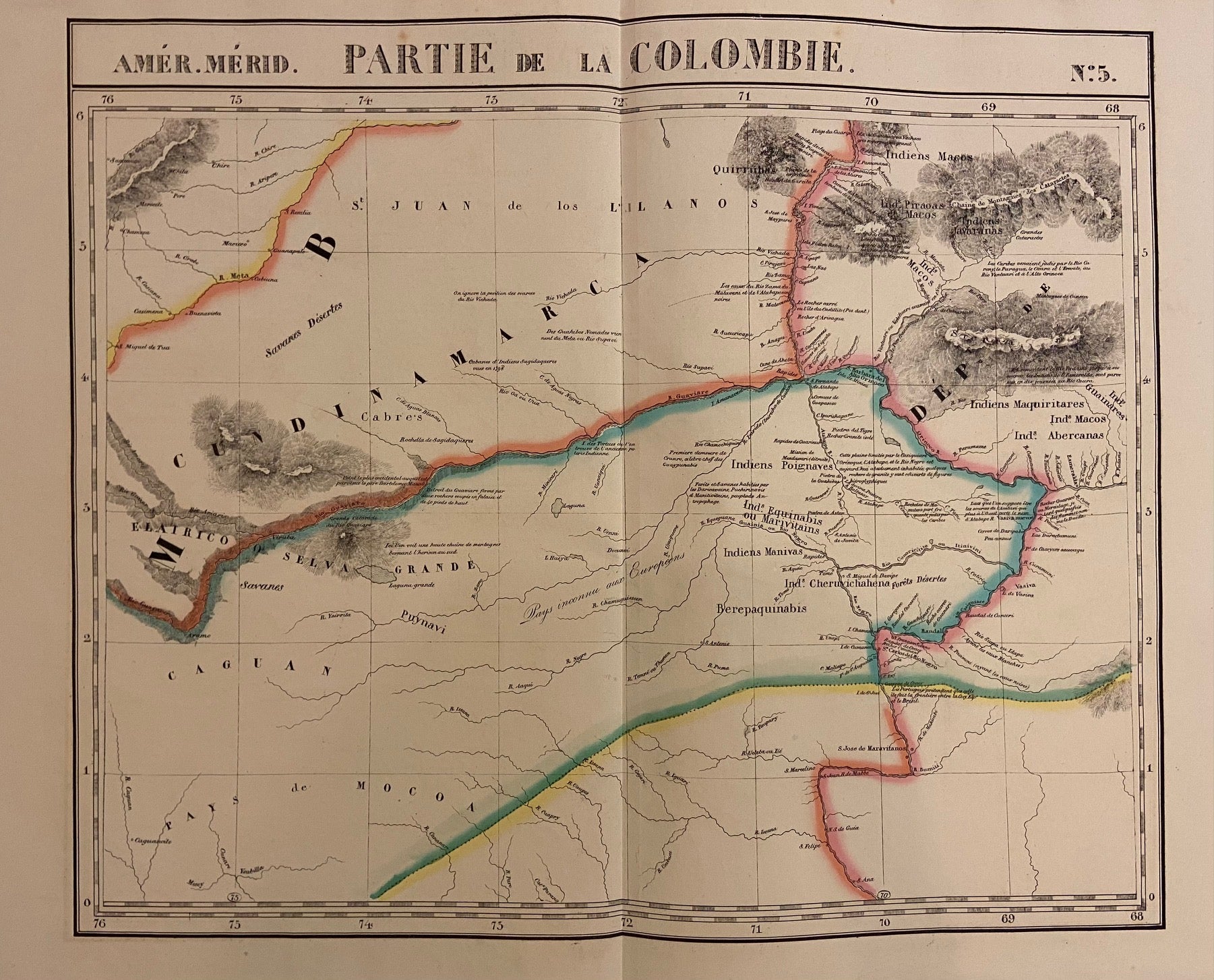
Partie de la Colombie. Amer. Merid. No. 5
Brussels: Vandermaelen, Phillipe Marie, 1827.
Map. Lithograph with original hand outline. Image measures 19" x 22.5".
Exquisite map of the Amazon region, at the borders of Colombia, Venezuela, and Brazil. Shows important rivers - Orinoco, Guaviare, Inirida, and Rio Negro. Many native indigenous groups are labeled. Notations on the map describe the terrain, the native peoples, and colonial activities in the region. Double page with centerfold. From Vandermaelen's 6 volume "Atlas universel de geographie physique, politique, statistique et mineralogique". Can be combined as gores to form an immense globe. The atlas was the first to map the world on a uniform scale.
Binding: Unbound
Language: English
Price: $265.00
Item #302381