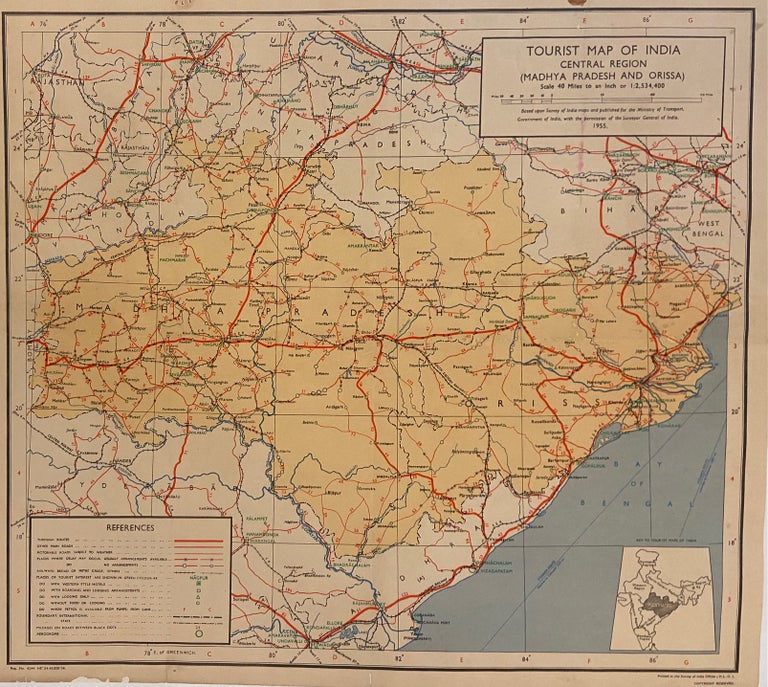
Tourist Map of India: Central Region (Madhya Pradesh and Orissa)
Survey of India, 1955.
Map. Color lithograph. Measures 18" x 20"
Mid-century tourist map of Central India, from 1855 extending from Kota to the Bay of Bengal (the present-day states of Madhya Pradesh, Maharashtra, Chhattisgarh, and Odisha). Shows road networks, including through routes, other main roads, motorable roads subject to weather, places where delays may occur, and where arrangements are and are not available. Railways, airports, and tourist services are also labeled. Stains to upper margin some light folds but otherwise in good condition. Based upon Survey of India maps and published for the Ministry of Transport, Government of India, with the permission of the Surveyor General of India.
Language: English
Price: $85.00
Item #301387